
By: David Coe Ph.D Student
Record high temps in the mid to upper 70s have been seen across the region this weekend with multiple stations setting new daily records Friday and Saturday! Yet, just last week we were looking a bit more wintry:
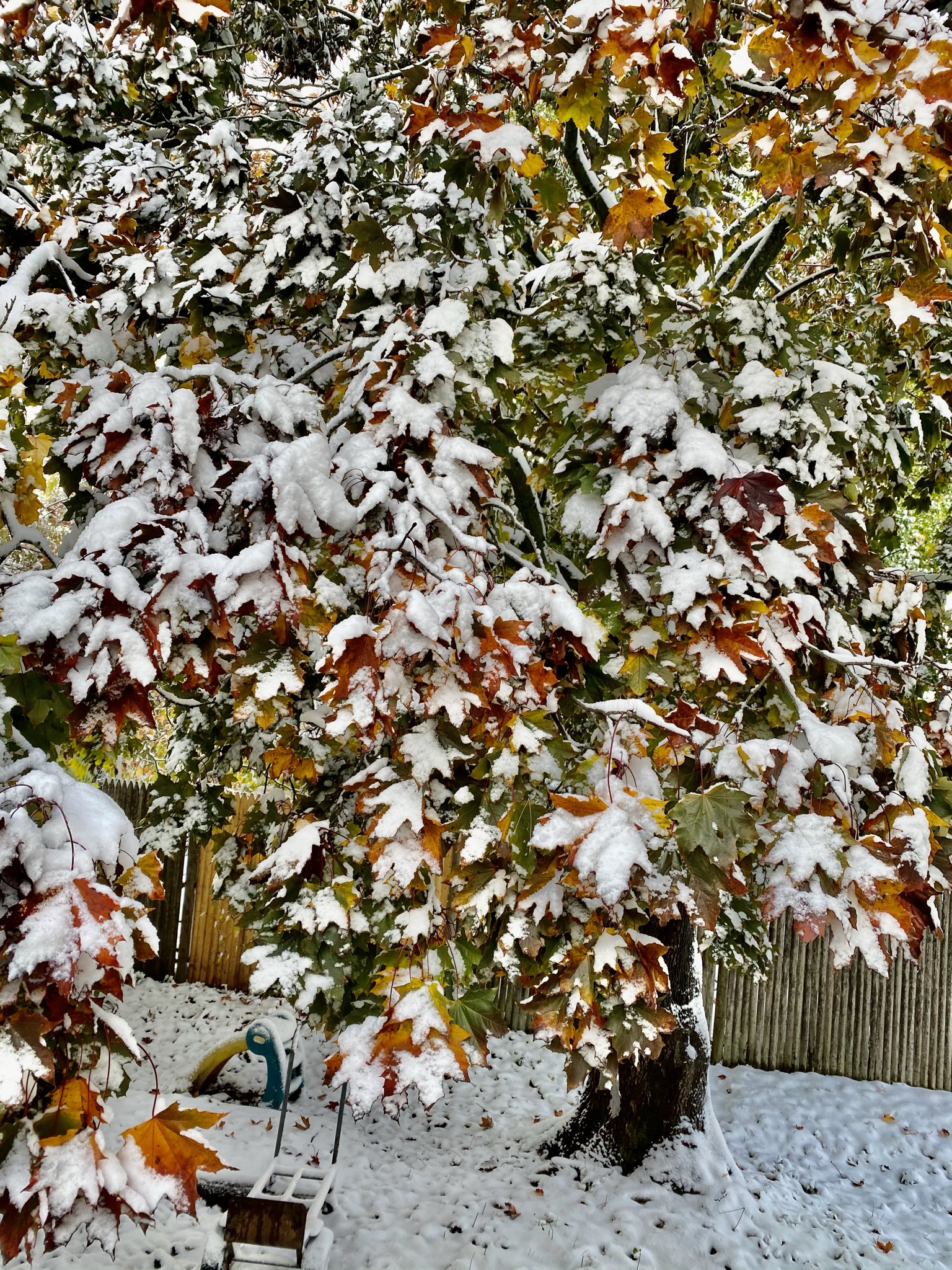
We saw our first significant snowfall of the season the end of October, reminiscent of 2011. If we look back at 2011, that was a warmer than average winter with very little snowfall (we recorded a total of 12.2” in Lowell with no snow record in December or February!). However, numerous studies have looked into a correlation between October snowfall and snowier/snowless winters and found that there is no correlation. So then, what does that leave in store for us?
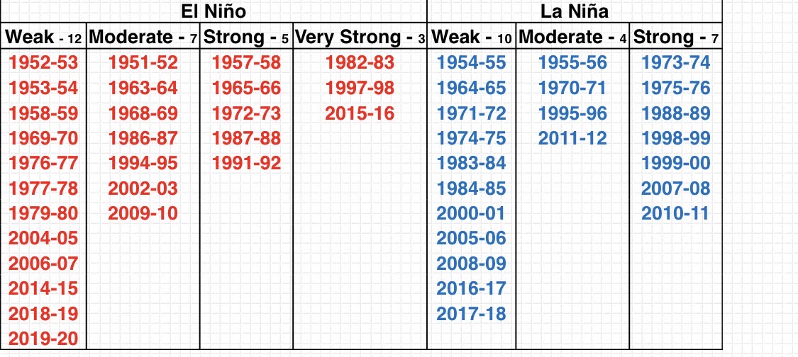
A better correlation exists in the ENSO cycle. While many studies have found their to be little to no direct influence on our weather, it does have some influence on our wintertime patterns that we see.
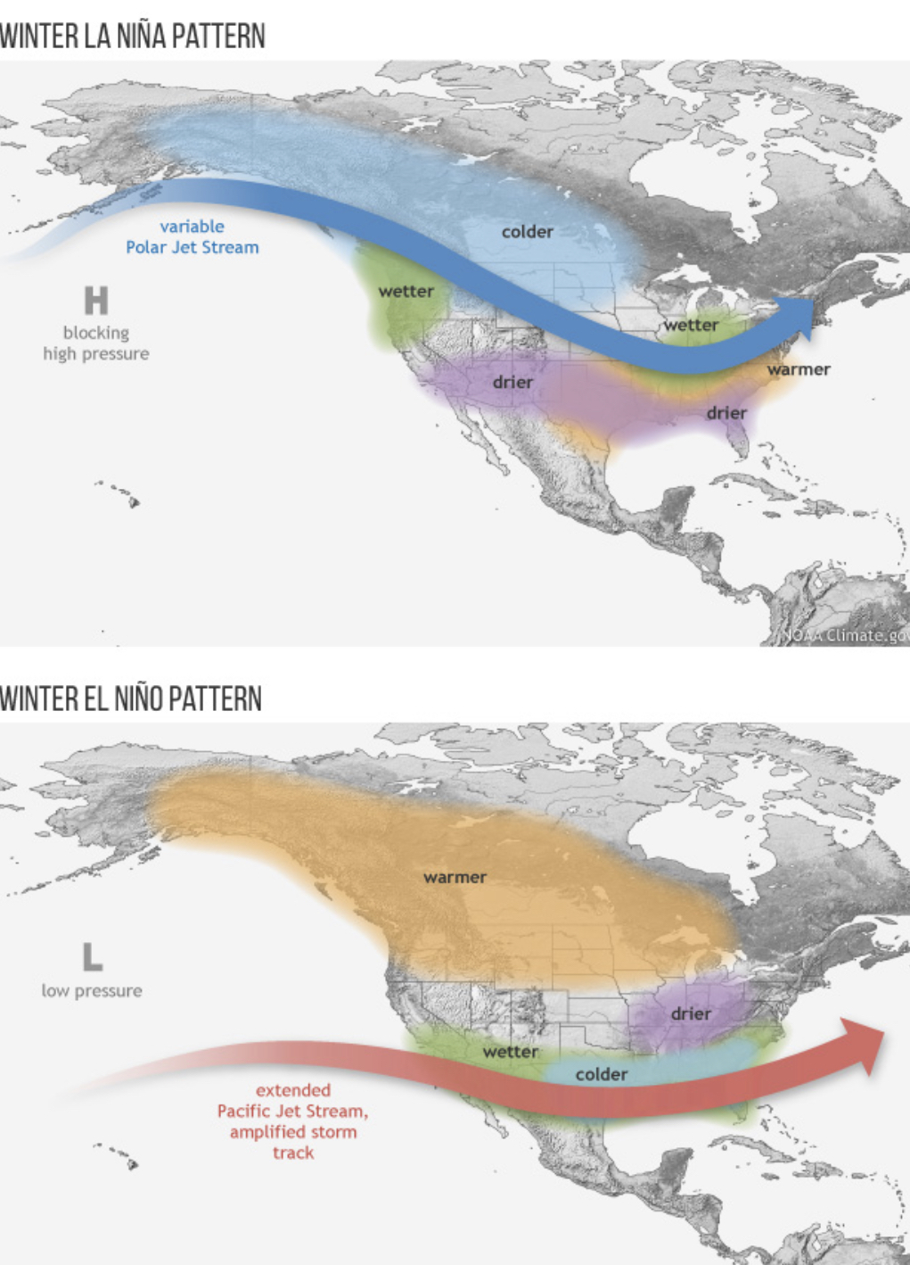
In a La Niña pattern, which we are in this winter, we tend to see above average temperatures and less precipitation. This isn’t a sure bet though, as there have been La Niña years where we have received plenty of snow:
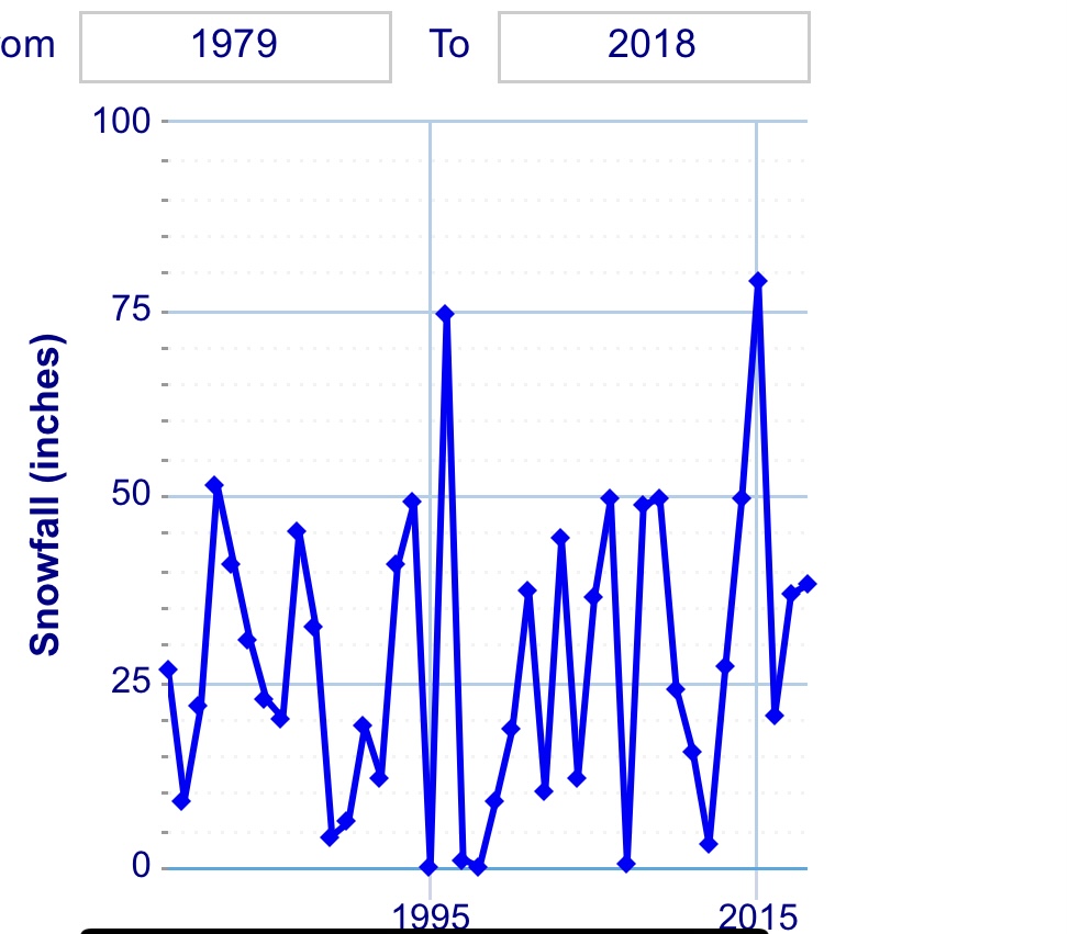
1995-1996 winter we saw almost 70”+ of snow and it was a moderate La Niña year. If we look at 2011, that was also a moderate La Niña year, but we had very little snowfall outside of October. So then, what can we say about October snowfall? Well not much, but there is currently one theory we are researching.
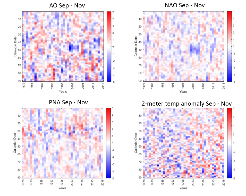
Our research is currently dissecting the transition from the fall season into the winter season. Our theory is that when we see these significant October snowfall events, the transition into our winter season becomes delayed. If we take our two years (1979 and 2011) with significant October snowfall, both show a warmer than average November. In the teleconnection, we see a negative NAO and negative AO in late October become positive both those years in November and stay relatively positive for the whole of the month, suggesting warmer than average temperatures. These coincide with long duration high pressure events over the Northeast, akin to the Bermuda high patterns we see in summertime. This is all just a theory and we are working with the data to understand the underlying dynamics, but so far, it seems to reason that significant October snowfall delays our transition into the winter season, leaving us with an unusually warm November.