
Good morning! The overnight guidance trended quite a bit warmer for the event tonight and tomorrow, so let’s dive right in!
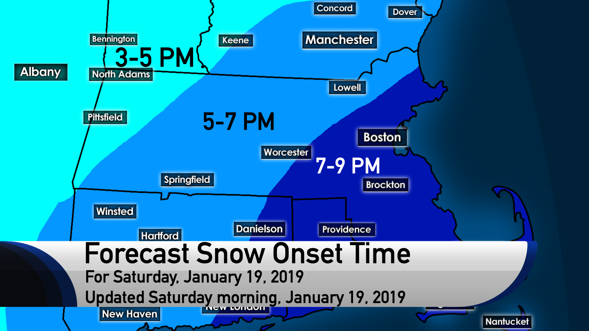
Timing and Precipitation Type
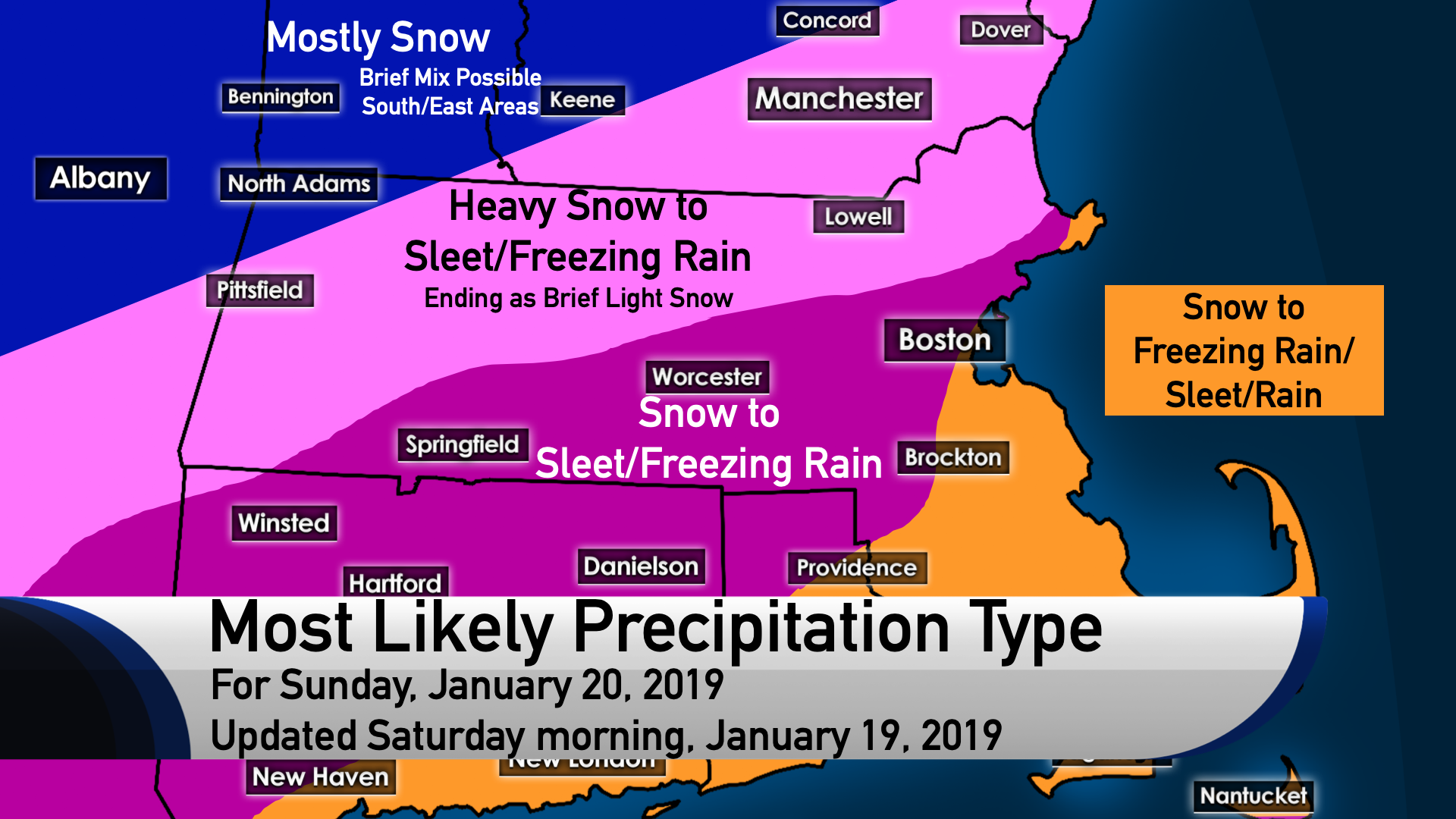
Snow begins during the 5-7 PM timeframe this evening. This could pose a few travel issues, but the serious problems don’t begin until after about 9 or 10 PM. Heavy snow continues from around midnight until around sunrise Sunday, when mixing with sleet or freezing rain will begin. A mix of snow, sleet, and freezing rain continues until late afternoon, when all snow is once again briefly likely for an additional very light accumulation as steady precipitation ends. Additional snow showers are possible in the evening.
Uncertainty
The exact time of mixing beginning may result in some changes to the snowfall amount. I still think we will get walloped during the overnight and early morning regardless, but it could just add even more to the final number if colder air holds serve for a little while longer aloft. However, overnight guidance trended to a warmer airmass aloft and a slightly quicker entry of the freezing line aloft, along with the freezing line pushing much farther north. Still, even slight differences in timing could result in some differences in snow amounts.
Snow, Sleet, and Freezing Rain Amounts
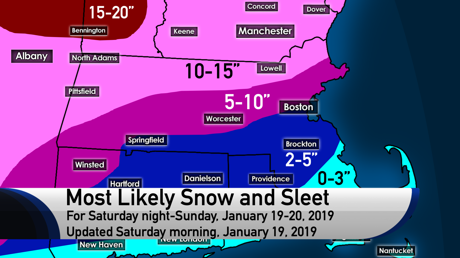
DISCLAIMER – The amounts below are still subject to change!
I am expecting a widespread 10-15 inches of snow in northernmost Massachusetts, including the immediate Lowell area; as well as much of western Massachusetts, portions of eastern Vermont, and much of New Hampshire and Maine. Even with mixing taking over around daybreak, the front end snowfall will be enough – with high enough snowfall ratios for a time, as cold air predominates overnight in this setup – to approach the one foot marker. Most of the accumulation in this zone is from snowfall overnight Saturday night and early Sunday morning, with an inch or two coming from sleet for most.
A few places could near 20″ in southwest and central Vermont and into upstate New York, where a 15-20″ zone is included. However, the chance for higher end amounts has decreased in New Hampshire.
Going south, a relatively sharp gradient exists, with 5-10″ for most locations inside and west of I-495, and north of the Mass Pike. This includes MetroWest, the North Shore, the Worcester area, the northern suburbs of Boston, much of the Connecticut River valley in Massachusetts, and northwest Connecticut. The 5″ line runs right through Boston to express the uncertainty in snowfall for Boston specifically. Expect 2-5″ for the southern suburbs of Boston, much of Rhode Island, northern parts of southeast Massachusetts, and much of Connecticut. Southern Rhode Island, southern Connecticut, and much of southeast Massachusetts can expect anywhere from nothing to 3 inches.
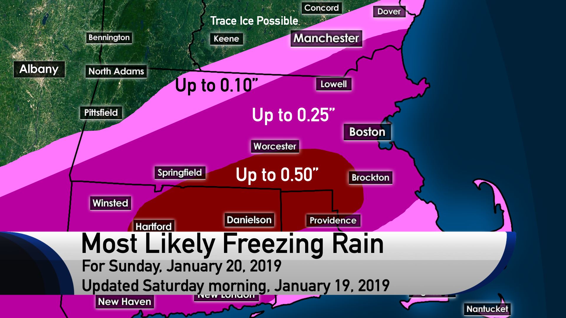
As for freezing rain, up to a quarter inch is possible for much of Massachusetts, much of Connecticut, and small parts of southeast New Hampshire. A trace to a tenth of an inch of freezing rain is in the range of possibilities for much of southern and central New Hampshire and a good portion of western Massachusetts, as well as far southeast Massachusetts and southern Rhode Island. There may be a narrow swath of localized icing amounts to a half an inch; if this happens, it would likely be in a corridor between Hartford, Providence and Worcester. Scattered power outages are possible in that area if the higher end ice threat materializes.
Significant travel impacts are in the cards, so once the onset of accumulating snow begins, travel isn’t recommended. Be safe!
 Forecast by UML student meteorologists Nathan Coram, David Coe, and Danny Couto.