The Scenario
Thanksgiving week is one of the busiest weeks of travel during the year and any chances of adverse weather, especially across Northern parts of the U.S. that are just entering their wintry precipitation months, can impact millions of Americans and their holiday plans. This year, we have yet to see much in the way of wintry precipitation in the Northeast U.S, but that could be changing next week. Cold air settles in this weekend across the Northeast and a frontal system looks to impact the region with some precipitation early next week. Since this is mid-range (3-7 days out), there is high uncertainty with respect to where, when, what type, and how much precipitation will fall. While they cannot directly predict the weather, looking at typical circulation patterns and sequences that occur during this time of the year can give us insight as to where to expect cooler/warmer temperatures and precipitation.
Autumn Circulation Patterns
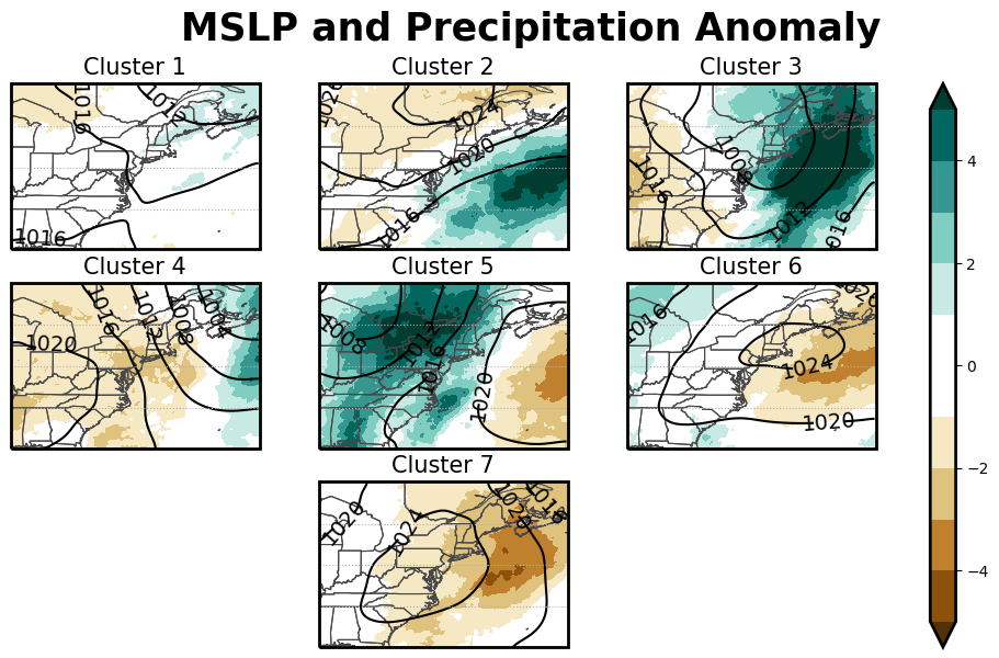
In on our research in Coe et. al 2021, we identified 7 typical circulation patterns that occur in the Autumn Season across the Northeast U.S. These patterns show seasonality, with 3 (Clusters 1, 2, and 6) mainly occurring from September to mid-October and 4 (Clusters 3, 4, 5, and 7) mainly occurring from mid-October to November. Each cluster has its own circulation, temperature, and precipitation characteristics and tend to transition between each other in distinct sequences. Since we are in November, we will be focusing on Clusters 3, 4, 5, and 7 and the typical transitions between them.
Cluster Matching to New Data
Using a method of Deep Learning called Siamese Neural Networks (see the post from the other day here!), we are able to take circulation fields from the GFS model for the upcoming week and assign them to a cluster. When doing so, we see the next week is dominated by the typical November circulation patterns. We also see two sequences that typically occur during this time of the year, Sequence 5-4-7 and Sequence 5-3-7. Let’s look more in depth at those two sequences and what weather is typically seen during them.
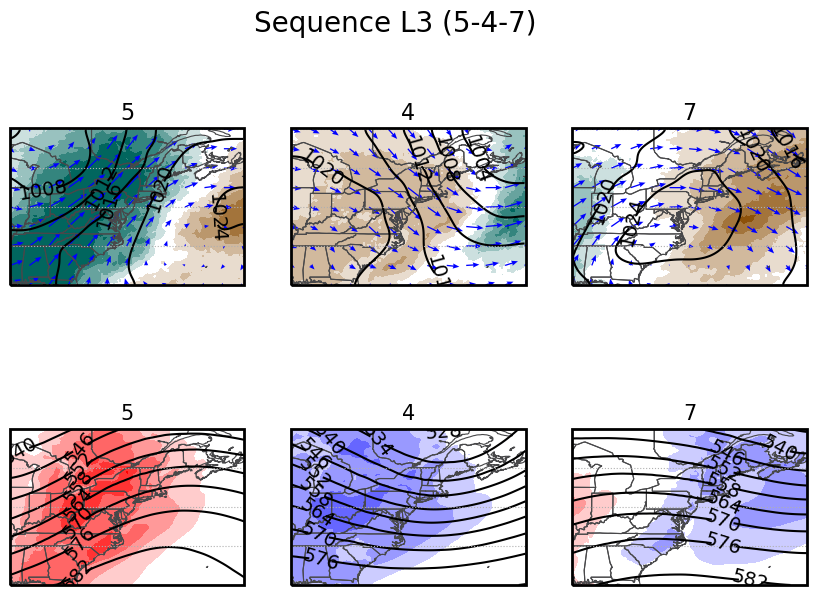
Sequence 5-4-7: The Cold Bringer
To end this week, we are entering Sequence 5-4-7. This sequence is characterized by cool, high pressure that is displaced by a frontal system which drives flow from the South/Southwest. This brings warmer than average temperatures to the region along with heavy precipitation. These precipitation events are quick events, typically not featuring extreme precipitation. Once over, cold air is forced back into the region as high pressure takes over.
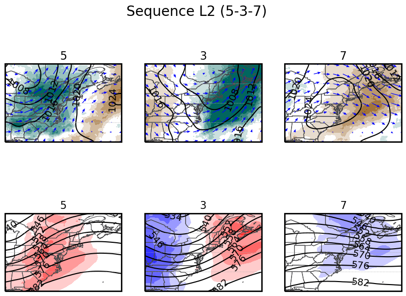
Sequence 5-3-7: Bringing the Rain
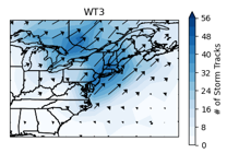
After cold air rushes back in on Friday and Saturday, we progress into Sequence 5-3-7, which typically follows sequence 5-4-7. This pattern is the typical wet weather pattern during November, featuring a slow moving low pressure area that crosses the region. Looking at storm tracks, there are two main places storms travel: 1. Across Southern New England from the Atlantic. 2. Across the Great Lakes and Northern N.Y.
Looking ahead to next week, the amount of precipitation and type of precipitation we see will depend on which of the two storm tracks the system takes. If it goes to the north, then we will see minimal precipitation in the form of rain. If it goes south, that will be a more interesting story. Overall, we can expect cooler than average temperatures for Thanksgiving week with a good chance for some precipitation in the beginning of the week.