
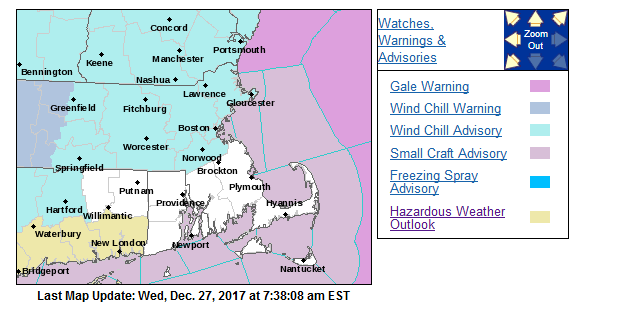
After our wintry Christmas Weekend be prepared because Jack Frost is coming into town and he is looking to bring a chill to everyone’s bones. We are under a wind chill advisory beginning tonight and lasting through Friday!
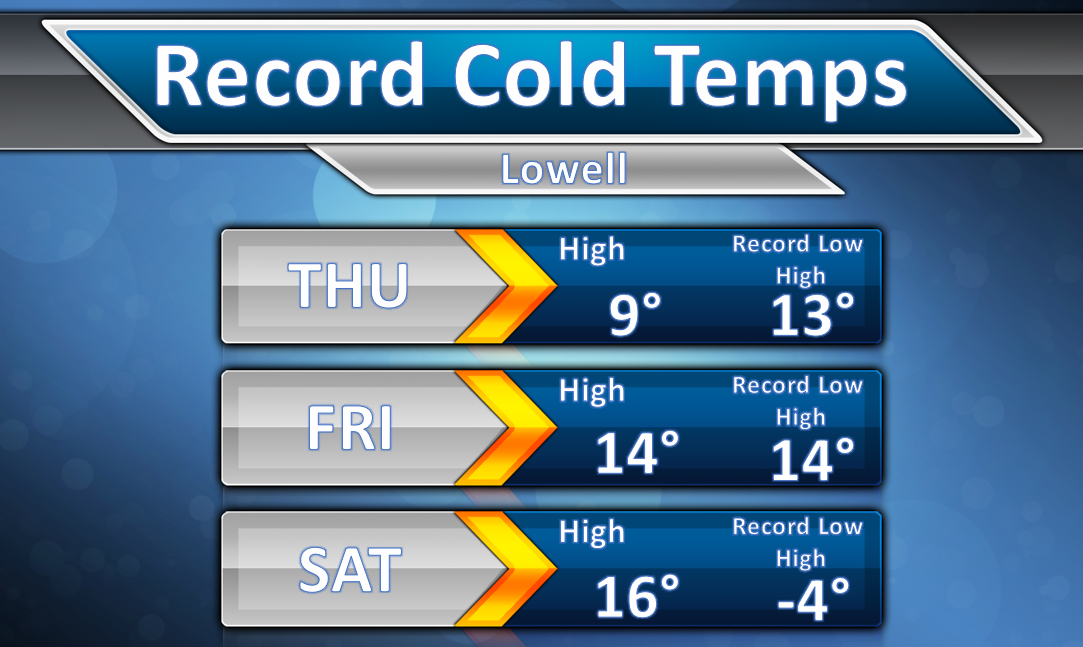
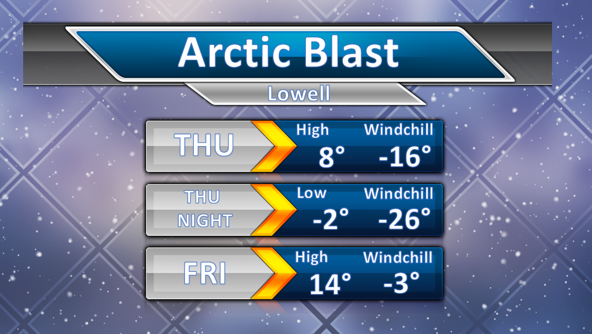
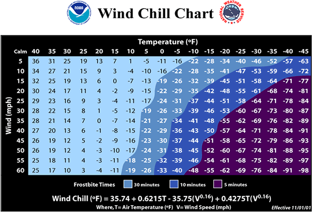
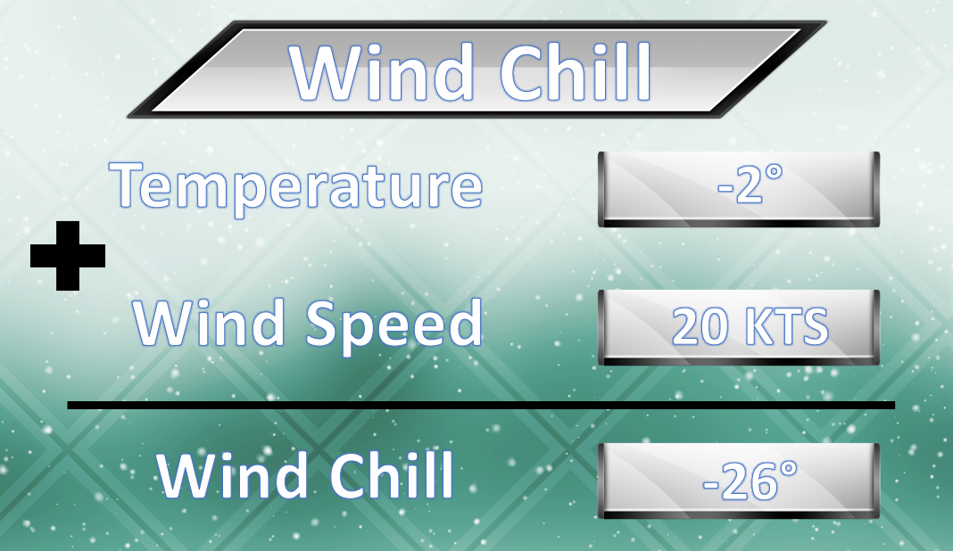
An area of Arctic High Pressure is pushing South and East through Canada this week and will make its way towards New England by this weekend. That does not mean we won’t feel its effects sooner though; once it reaches the Upper-Midwest (Tomorrow and Friday) we will feel the winter chill. This means DANGEROUS conditions through the day Thursday and especially during the night Thursday through the morning Friday. Temperatures Thursday reach records low Highs in the upper single digits, but by night, they plummet to between 0 and -5°! These temperatures alone are dangerous to both Humans and Animals if outside for more than 10 minutes, but the other factor we have to worry about is the wind chill. Winds become gusty Thursday afternoon gusting between 20-35 mph through the evening before beginning to diminish to gusts between 10-20 mph on Friday. Looking back in the record books, Thursday’s High temperature looks to break the record for Lowest High Temperature in Lowell for this date of 13° set back in 1933! Friday could also break or tie its record of 14° for the Lowest High Temperature set back in 1946! Saturday looks to remain well above its record Low High Temperature of -4° set back in 1933 (the only day on record that we never reached over 0°!).
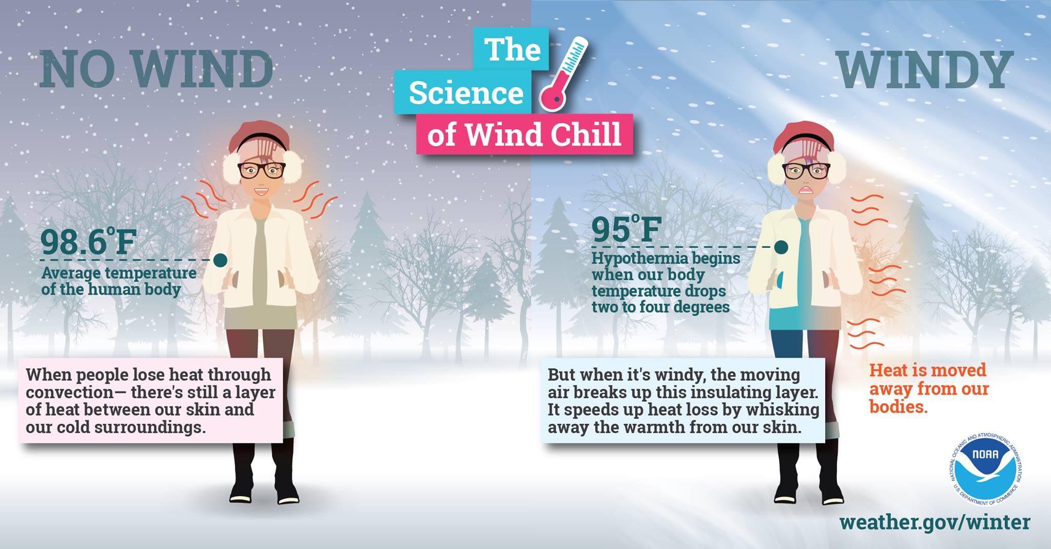
Wind Chills will be the main concern Thursday afternoon and evening with values during the day on Thursday being between -10 and -20° and values Thursday Night and Friday morning being between -20 and -30°. This is extremely dangerous and could lead to Frostbite and Hypothermia within 20-30 minutes of exposure! So please take caution when going outside and make sure to cover up any exposed skin and please do not leave animals/pets outside for more than a couple minutes and cover them up as well if you can! Also, check on your elderly neighbors to make sure their heating works and that they are not suffering in the cold, they are the most susceptible people to hypothermia in these conditions!
Following this into the weekend and New Years, we see the area of High Pressure begin to move its way eastward towards New England. This could lead to dangerously cold conditions for New Years eve with temperatures by the end of celebrations being well below zero in most areas! This is still a ways out and there are many factors at play ( a potential ocean storm being one of them) that could influence the overall outcome. Right now, it is safe to say that the New Year looks to begin with an Arctic Blast.