
Good morning! Quick tweak to the forecast to account for continued trends favoring a major snowfall.
What’s Changed:
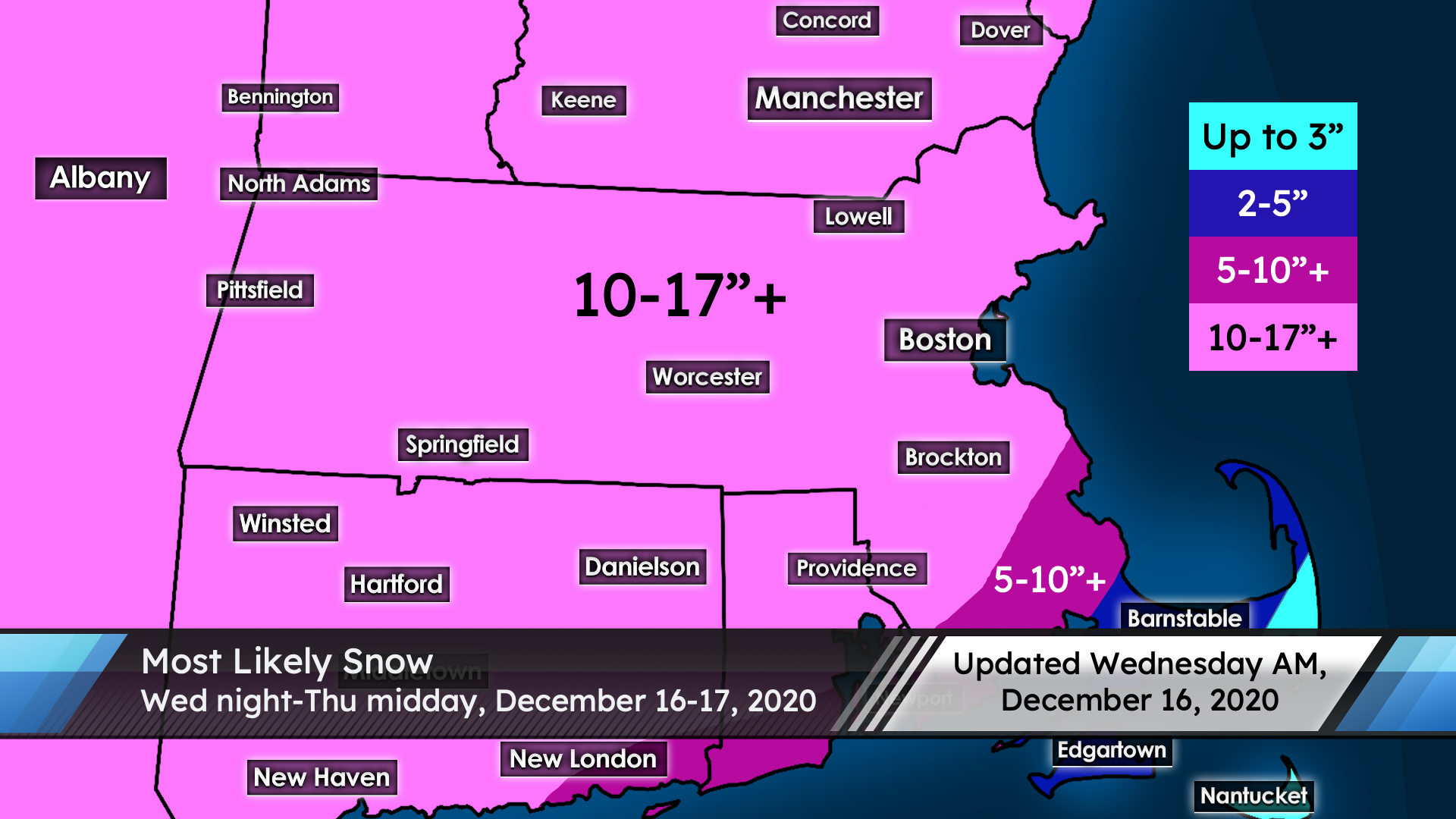
Not much. The 10″ line has been brought further north in relation to last night’s forecast, and snow totals are tweaked in southeast MA.
Timing:
Snow begins late this evening, just before midnight. The heaviest snow falls overnight tonight and into tomorrow morning’s commute, with the potential for over 2″ of snow per hour at times. Snow lightens in intensity some by late morning and ends completely by mid-afternoon.
Amounts:
Widespread 10-17″ snow, with the potential for isolated higher amounts. Where exactly we end up in the range depends on where bands set up, but this is about as clear-cut as it can get. This will be a light and fluffy snow for most locations throughout the storm, including the Dracut/Lowell area, where we will be in the teens to mid 20s throughout the storm. Areas closest to the coast as well as around Boston will start with a slightly wetter snow (but not a super wet snow by any means) but the bulk of the snow there will still be on the lightweight side. Mixing concerns do exist in southeast Massachusetts, where forecast snow totals are lower.
Uncertainty:
Not much uncertainty at this point. There are enough factors going our way that it would take multiple large failures for us to not reach 10″ of snow. An area of subsidence is being picked out by most models extending from roughly Manchester to Worcester with slightly lower precipitation totals, but the snow ratios should be high enough to more than compensate for that and get those places to 10″. Locally, the main question is whether we end up on the low end or the high end of the range, and only time will tell for that question. Get ready, everyone – this one looks like a hit.