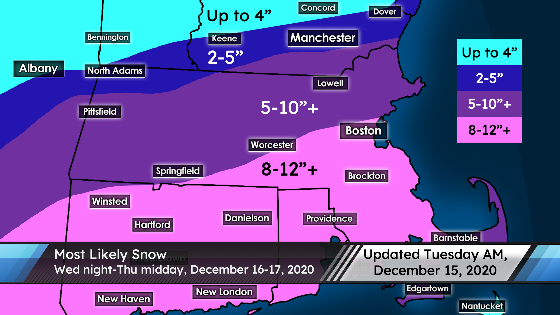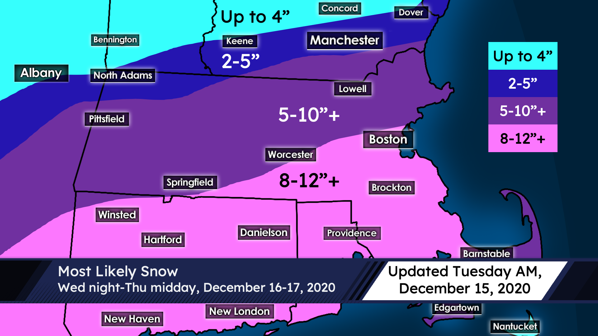
Timing: Snow begins around midnight Wednesday night. The heaviest snow will likely be toward the morning commute hours, before tapering off around midday and ending by early afternoon. Over 1″ per hour of snow will be possible at times, but the higher risk for especially heavy totals is to our south (more on that in a moment).
Amounts: Given the sharp northern cutoff with this system (which I will get into in the “uncertainty” section), I am doing something a little unusual and going with overlapping forecast amounts. The good news with this system is the snow will be lightweight and fluffy throughout the area! Expect up to 4″ in central New Hampshire; the distance between no snow at all and several inches of snow may be very sharp. A narrow swath of modest 2-5″ is likely for most of southern New Hampshire, with the potential for isolated higher amounts if the stars align. From there, a widespread 5-10″ – with higher amounts possible – is likely for much of northern and western Massachusetts including the Dracut/Lowell area. This 5-10″ zone also encompasses extreme southern New Hampshire including the Manchester to Nashua corridor. Most locales along and south of the Mass Pike sit in an 8-12″ zone, with higher amounts possible. This includes Boston and Worcester, as well as all of CT, RI, and much of southeast MA. These zones are subject to change though, so stay tuned.
Uncertainty: The good news is this is nothing like the December 5th storm. There is lots of cold air available with this system, so precipitation type is not a concern. The main worry is with the northern cutoff of snowfall, which will likely be somewhat sharper than currently modeled, given the influence of high pressure over Quebec. If the system tracks slightly more to the north, this opens up a greater possibility of higher-end amounts over 10 inches. However, a tick to the south would give us a more modest snowfall than currently projected. Almost all data shows us having enough precipitation to get to 6″ of snow, and some show a fair bit more than that, but the margins are relatively narrow. Given the cold air with this system, the snow will be a dry, fluffy, lightweight snow, which will make snow-to-liquid ratios rather high (likely 15:1 or higher). This means that even if we get a little less moisture than anticipated, the cold air will compensate somewhat. The issue with the December 5th storm wasn’t available moisture or track, it was an issue with significantly overestimating the snow-to-liquid ratio due to the marginal and unstable nature of the cold air of that system. We won’t be in for that kind of a system, thankfully. I’m much more confident in this forecast than that one, but as I mentioned, the northern cutoff could still find a way to mess with us locally.