Good morning! Student forecaster Nathan Coram here with the 5-day forecast as well as a forecast for tomorrow’s storm.
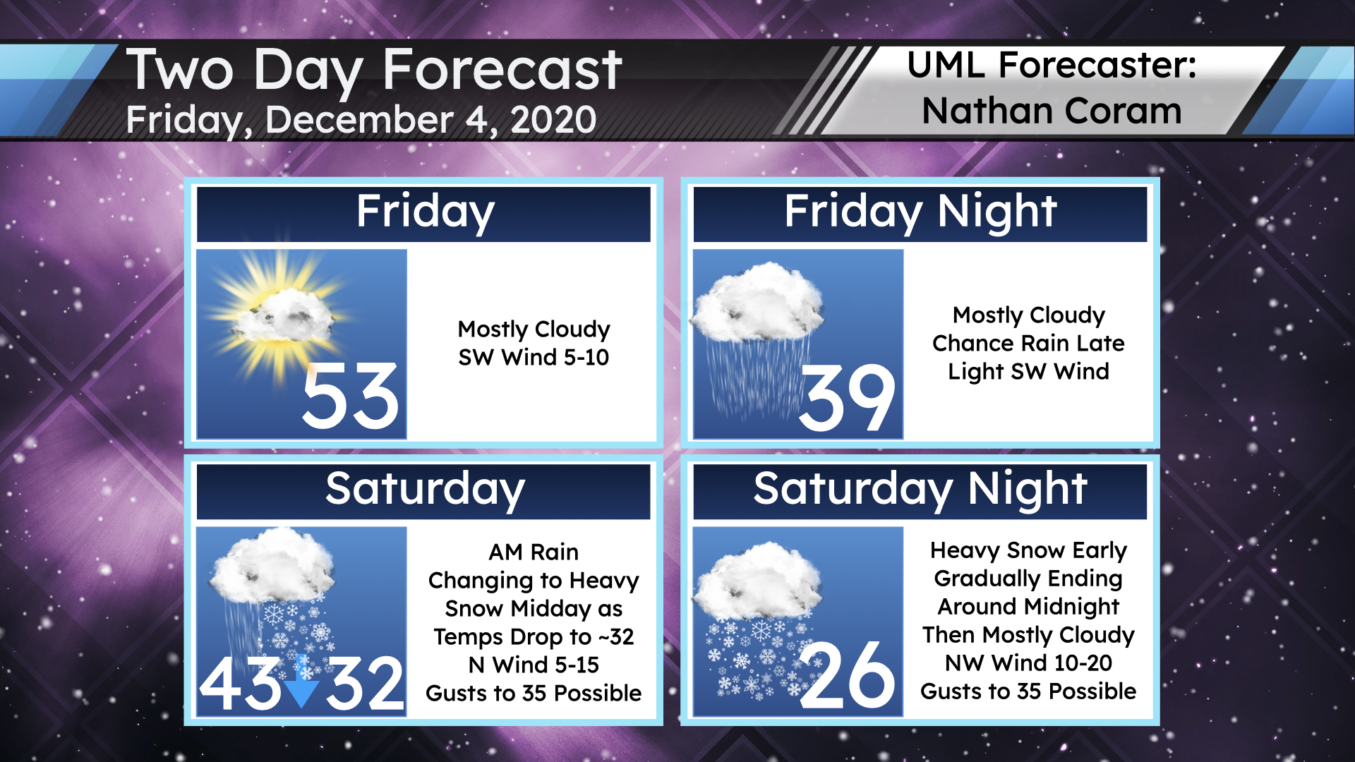
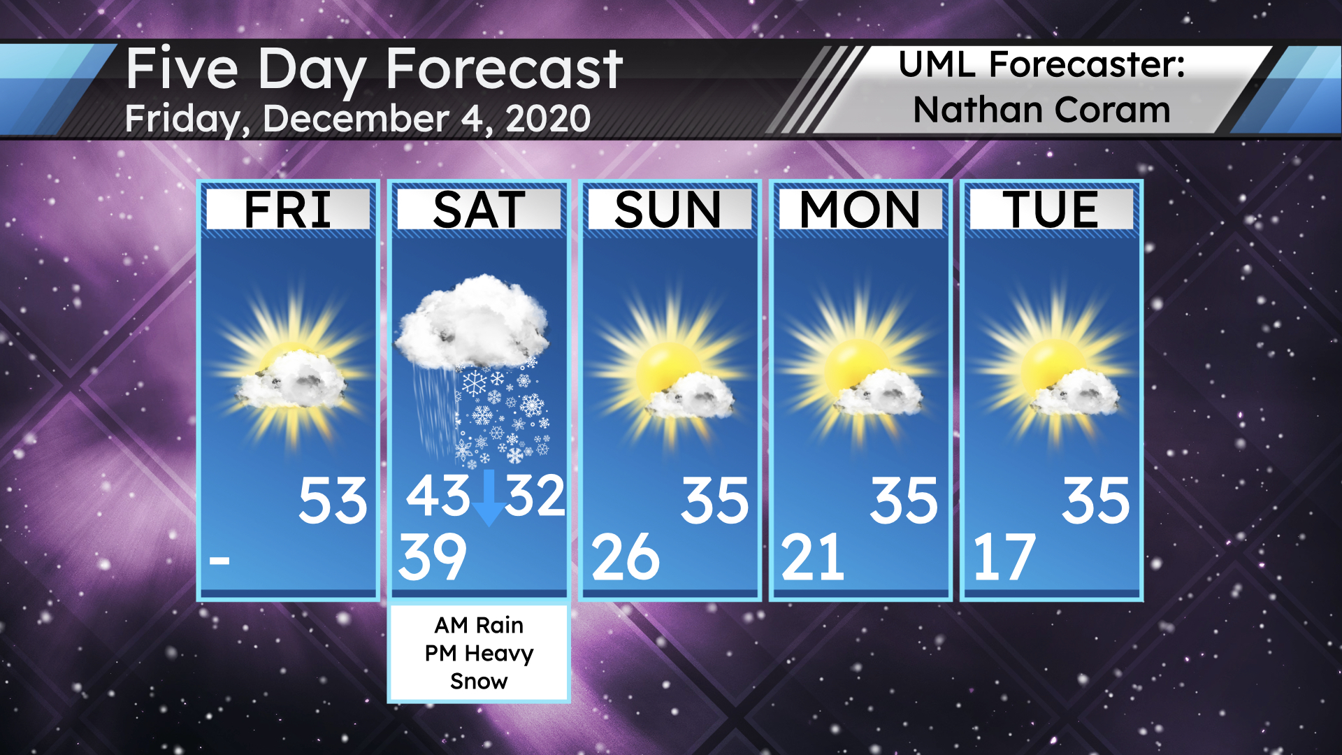
We have a storm on our hands, so let’s quickly run down the next day and a half or so first. With mostly cloudy skies, expect a high around 53 today, with a southwest wind of 5-10 mph. Tonight will be mostly cloudy, with a low around 39, a light southwest wind, and a chance of rain late. Expect heavy rain tomorrow morning, with the high temperature of 43 occurring around mid-morning. Temperatures then fall to around the freezing mark by midday as heavy rain flips over to heavy snow. For a time during the afternoon and evening, snow rates well over 1″ per hour are possible. This will make for poor driving conditions, and whiteout conditions are possible at times with a northwest wind of 5-15 mph gusting up to 35 mph. Snow wraps up by around midnight or so Saturday night. Power outages are also possible. My going forecast calls for 5-10″ of snow for much of northeast Massachusetts and southeast New Hampshire. More details regarding uncertainty follow.
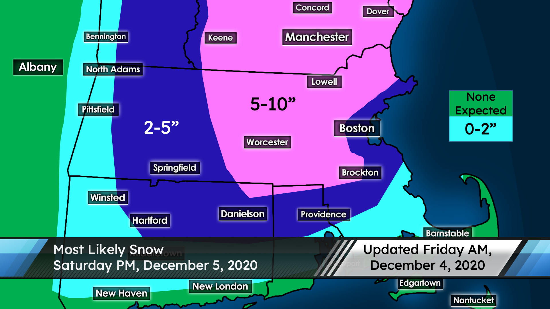
There is increasing confidence in significant snowfall amounts as guidance is settling in on a classic “benchmark” track that is favorable for snowfall in interior eastern New England. However there is still some uncertainty here. Given the likelihood of an especially heavy snow band setting up, it’s possible we could over-perform even the 5-10″ forecast; when all is done, some places may see over a foot of snow, but confidence is not high enough to add a 10″+ tier. Depending on trends, such an update may be necessary this evening (such an update won’t happen until after 9 pm, because of work).
The other end of the uncertainty stick is with amounts at both the immediate coastline as well as in western New England. The obvious caveats always apply at the coast regarding warmer temperatures, but temperatures will be marginal everywhere and this storm is reliant on very heavy snow rates, so it’s possible that heavy snow could occur right up to the coast – likely not to the same degree as inland, but the northeast MA coast will likely approach the 6-inch snow mark.
As for western New England, the system’s eastward trend is leaving less overall precipitation for that region, and some guidance is now indicating a near-shutout out that way. There is still some guidance on board with heavy snow out that way, so while the odds are decreasing, there is still tons of uncertainty in western New England that should resolve soon.
While this now seems very unlikely, it’s also not entirely impossible that this ends up being an underperforming system locally as well. Overall, this forecast is much less stable than we typically have so close to the onset of a storm.
The system’s departure gives way to temperatures falling to around 26 Saturday night, with a northwest wind of 10-20 mph, gusting up to 35 mph, and mostly cloudy skies. Skies turn mostly sunny Sunday, with a high around 35. Sunday night will be mostly clear and 21. Monday will be mostly sunny and 35; Monday night will be mostly clear and 17; Tuesday will be 35 and mostly sunny.