
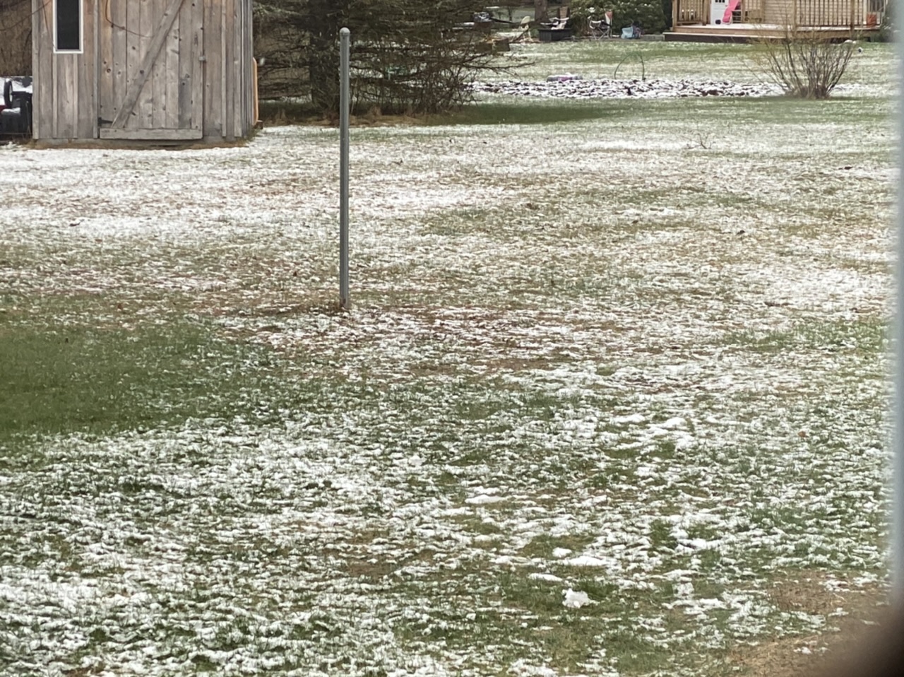
All of us across Southern New England woke up to a snowy scene this morning with some areas seeing almost 6” of heavy, wet snow.
April snow isn’t all that uncommon in New England, we’ve had our fair share of April Fools Day blizzards (looking at you 1997 and 2017!). However the one noticeable (and some people would say very nice) aspect of it is that it doesn’t tend to last that long. When we think of snow here in New England, it’s usually, here today gone in two months.
Why does April snow melt so fast??? Here’s where you say, “hey mr Blog Writer, it’s much warmer in April than in January so the warmth melts the snow faster”. Of course, you’d be right, plain and simple, so the blog post is done…right? Well this post is here to explain some more reasons as to why it melts quick and also explain why it doesn’t tend to accumulate as much as we predict it to.


Above was our snowfall predictions for this morning, not bad, we got the majority of the heavy snow areas right compared to the NWS observed accumulations. However areas north of the purple band (the heaviest snowfall) received even less snowfall than we predicted. Why is that?
Well it has to do with a factor that we call soil temperatures. First, take a look at this image:
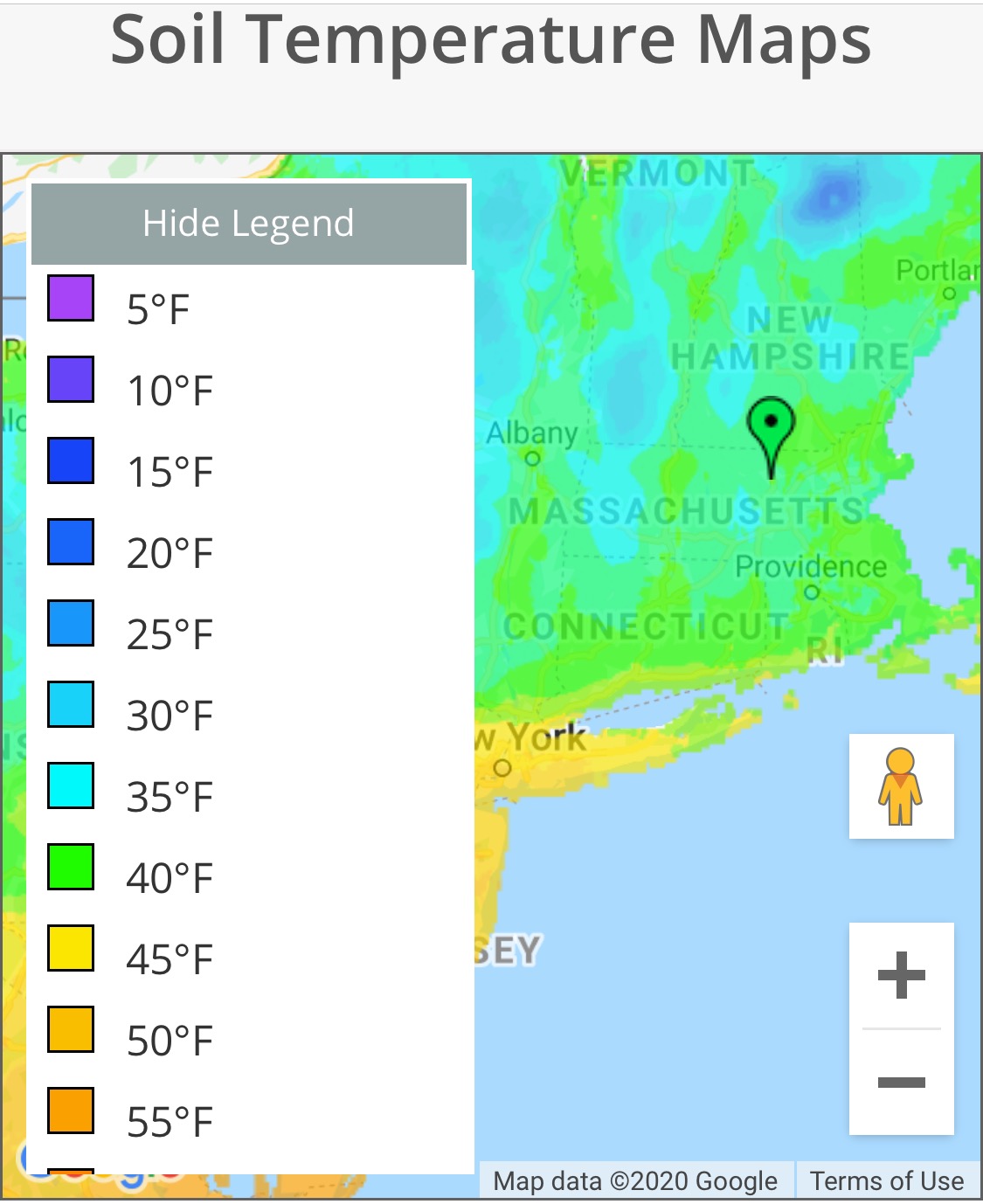
These were the soil temperatures for this morning across New England. Note that the majority of the region had soil temperatures above freezing. Why do we care about soil temps you ask? Well because the snow has to land on the ground (soil) to be able to accumulate! Even though the air above the ground was cold enough to support the snowfall, the ground was not cold enough to support it sticking. That’s what we call that good ole spring sun angle!
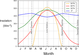
Sun angle you ask? The above chart shows what I mean. For our sake, we are concerned with the red shaded line as it covers close to our latitude. Insolation is the amount of energy we receive from the sun, which changes throughout the year because of the tilt of the Earth. Think of it like a fan, if the fan is pointed towards you, you’ll receive all the nice cool air, whereas if it is pointed slightly up or down from you, the cool air will be more dispersed around you.
Here, we see our max insolation during the summer months, but we start to see an increase in March around the spring equinox. This increased sun angle and more insolation leads to increased heating of the Earth’a surface meaning warmer surfaces and warmer surface temperatures. The soil temperatures take awhile to warm up, as the ground is frozen most of the winter, but once it warms up in the spring, it stays warm until the next hard frost.
So even though the precip was snow this morning, until enough of it melted to cool the ground so that it could stick. This accounts for the lower totals seen in the northern parts of the state, but why did the southern part of the state see higher amounts? That is because they saw the heavier bands of snowfall in the storm. Heavier snowfall bands means that the snow doesn’t have time to melt on the ground before more accumulates, so it will continue to accumulate even while melting. This allows for the higher totals in those areas.