

Some like it hot, but it’s gonna be a scorcher here in New England for at least the next 5 days! 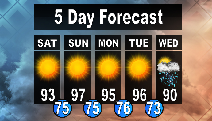
Bermuda High
You can thank a Bermuda high for these warm temperatures that we are seeing this next week! An area of High Pressure has been slowly moving its way across the country, bringing with it sweltering heat throughout the Midwest and Southeast U.S. It is finally going to reach the East Coast and slide off shore, setting up a conveyor belt of heat into the Northeast United States. It is aptly named due to its positing over Bermuda and as Bermuda makes you think of warm tropical air, this High Pressure system supplies it to the region! We do see a similar setup, albeit much weaker, during the winter months, which helps bring warm, moist air to the region to fuel our Nor’Easters. Bermuda Highs tend to take awhile to move out of the Region, usually requiring a strong frontal system or low pressure system to kick them out to sea.
Climatology
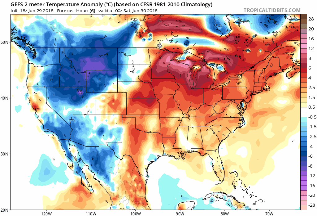
The above Ensembles from the GFS model show average temperatures around 5-10 degrees Celsius above average from the next week (where the average temperature this time of the year is already 27 degrees Celsius (81 degrees Fahrenheit!)) with a couple days seeing temperature anomalies in the 10-15 degree Celsius plus range! This is going to be sweltering heat, combined with high dewpoints, makes for an uncomfortable week away from coastal areas. Anyone with breathing problems, the young, and the elderly should take caution outside.
You may be thinking we haven’t seen a heat like this is awhile, and you would be right! It has been over a year since our last heat wave in Lowell (June 11th through the 13th of 2017 to be exact). Combined with the abnormally dry end of spring/beginning of summer, we have seen a lack of water which adds more stress when warm temperatures like this occur.
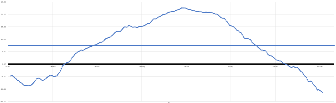
The above graph shows our average mean daily temperature (based on a 30-year Climatological record from 1980-2010) for each day of the year. We see that our average warmest temperature of the year occurs around mid-July, which means that the past couple of years have seen earlier hot high temperatures compared to the mean. This has been a trend over the past 5 or so years, which suggests that summers could indeed be getting longer and hotter earlier rather than later. By that I mean that summer may be starting earlier here in the Northeast, with the warmest temperatures occurring earlier than mid-July, but the warm temperatures will still last through our typical end of the summer season in August/September.
So enjoy the heatwave and stay cool! It’s not everyday we see one, but this summer is only just startin!