
Our first named storm of the 2018 Atlantic Hurricane Season is projected to make landfall today, bringing heavy rain and the potential for storm surge to the Florida panhandle and areas within 50 miles to the east or west of it. This storm quickly formed over the past few days off of the Yucatan Peninsula and thanks to a favorable environment in the Gulf Coast (warm waters and a strong upper level trough present), this storm was able to pick up the energy it needed to form a more coherent system.
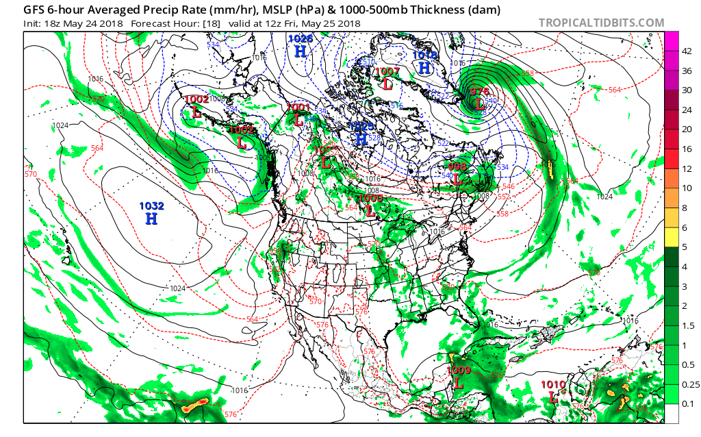
The image above shows the GFS model on Thursday. The Low Pressure Center located around the Yucatan Peninsula was under close scrutiny as since the beginning of the week, there was suggestion that it would form into a more powerful storm as it tracked northward. In the beginning of the week, it took form as a low pressure system that traveled to the northeast and would of brought heavy rains to Florida and the East Coast states, but the potential for a subtropical storm development was low due to a location outside of the Gulf. However, as the week went on, an upper level trough was stronger than originally predicted, meaning it could enhance the low-pressure system as it moved away from the Yucatan Peninsula, which meant a northward track into the gulf (a much more favorable tropical environment) was likely and on Friday the NHC designated this low pressure center as subtropical storm Alberto.
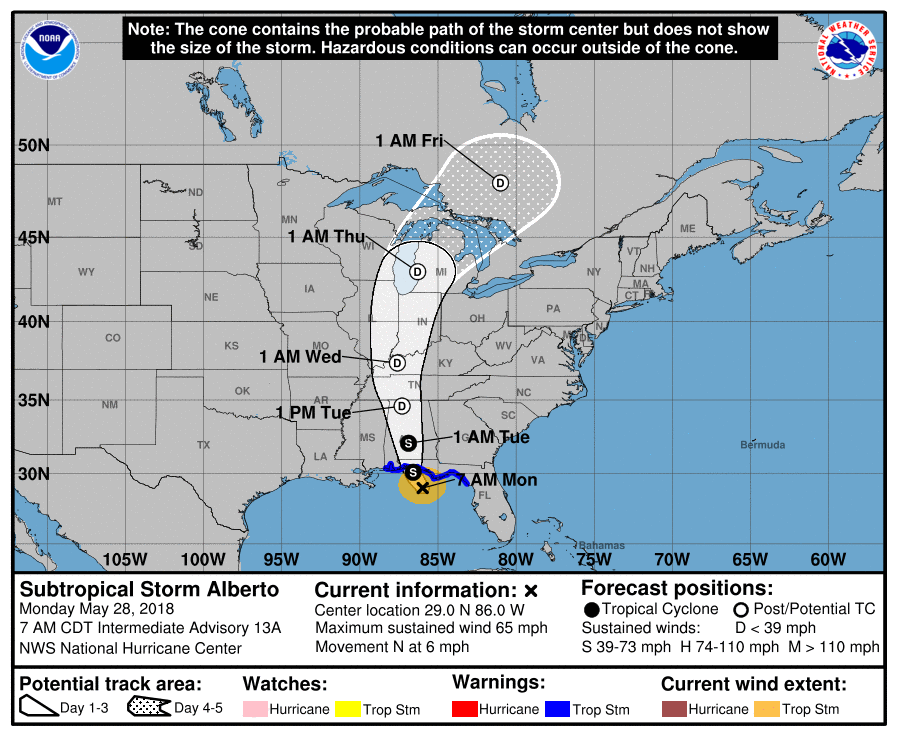
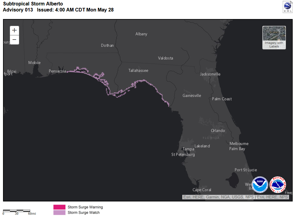
This morning’s update to the cone of uncertainty kept the storm in a similar position as it has been forecasted to be in since Sunday, just a shift further west as the storm significantly slowed down overnight, causing it to wobble further west. This does not change the overall track of the system as it still falls within the predicted cone and is expected to slowly make its way north and northeast once it makes landfall. Winds for Alberto this morning were clocked at 55 knots by air force planes, meaning that a Tropical Storm warning for the coast of Florida and Alabama was still warrant
ed. 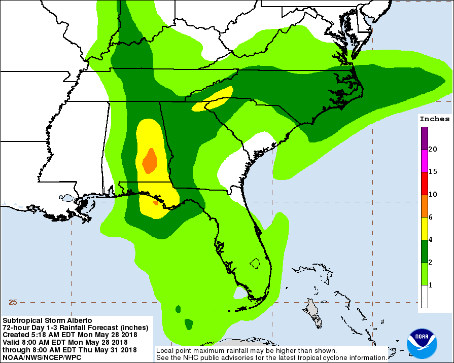
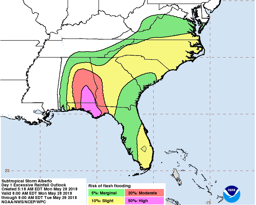
Impacts for the Panhandle of Florida and the Southeast U.S. include heavy rains, moderate wind gusts, flash flooding, and storm surge possibilities. These areas will see 2-5″ of precipitation fall within a 24 hours period leading to flash flooding in many streets and underlying areas. Combined with a moderate storm surge, this presents problems for coastal bound citizens. The storm will rapidly weaken as it makes landfall due to much drier air inland, leading to a rapid weakening by Tuesday. Eventually it works its way to the North and gets taken in by a low pressure system over the Great Lakes during the end of the week, bringing the potential for us to see some of its remnants next weekend for precipitation.