
After such a mild February, it seemed as though New England was in for an early spring. That is, until March came about…
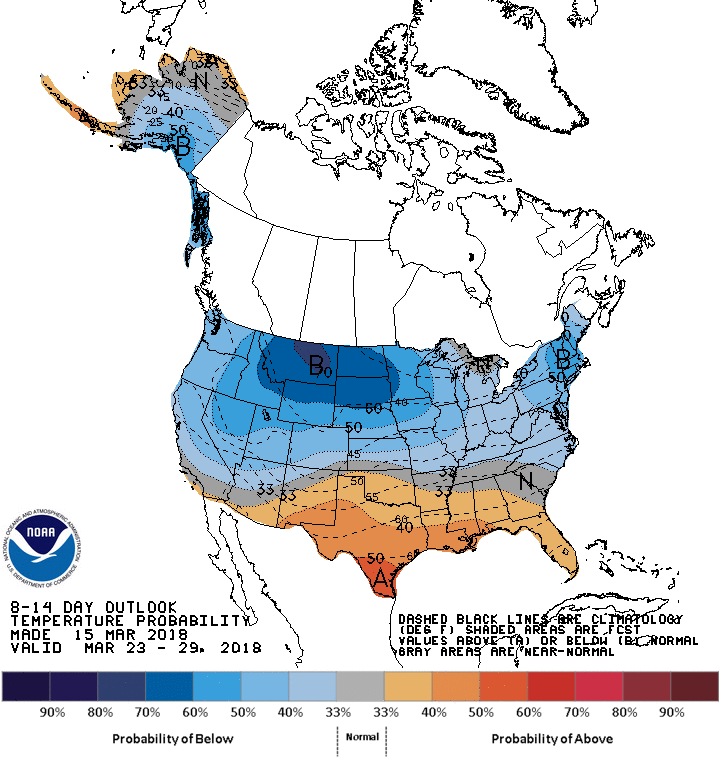
Barely 3 weeks into the month of and New England has had to contend with 3 consecutive Nor’easter’s. High latitude blocking remains locked in place which positions the jet stream in a way that results in a cold and active weather pattern for the Northeast. Great news if you like snow, bad news if you’re looking for any sign of Spring. Unfortunately, it seems as though this cold pattern remains persistent through the end of the month as noted by the Climate Prediction Center.
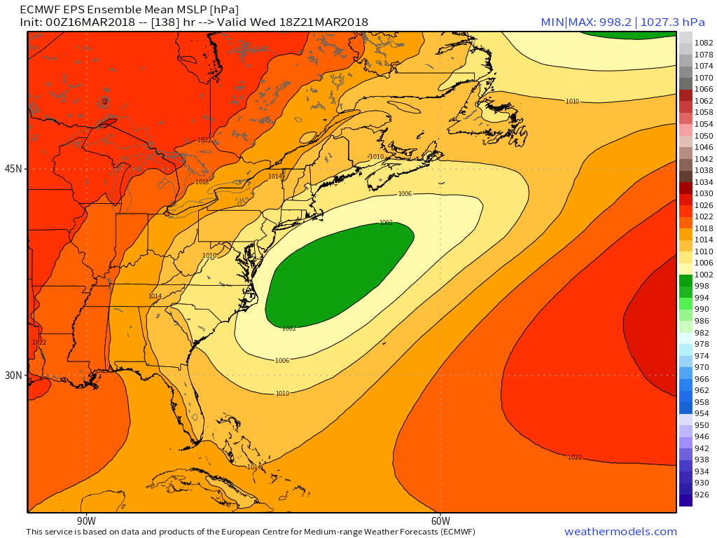
With this active jet stream still in place, yet another storm looks to impact the region in the late Tuesday – Wednesday time frame. With roughly 5 days to go before said event unfolds, there is a high level of uncertainty within model guidance. Both the American GFS and European ECMWF operation models have been back and forth on what exactly will happen. However both show an area of low pressure tracking right along the south coasts of CT, RI, and MA. With cold air locked in place and liquid precipitation values ranging from 0.75-1.5″ this puts a threat for yet another plow able event for Southern New England. However, if this storm actually ends up verifying, I do not think this will be an all snow event as of now, the track has been trending be too close to Southern New England which would allow for a rain/snow line to develop roughly along a New Haven, CT to Gloucester, MA line where everyone to the north/west would have the greatest potential for another heavy/wet snow event.
The ECMWF has been more accurate this winter than the GFS and thus would want to lean more on the ECMWF solution when it comes to these storms. What’s interesting to note is that the Euro Ensemble mean, which is a blend of different possible model solutions averaged together, indicates most of it’s members believe that this storm ends up passing well to our south and would only minimally impact southern/coastal CT, RI, and MA with only a few showers overnight Tuesday into Wednesday while the rest of MA would possibly only see a few flurries. This goes against the operational model, and will be interesting to see if it will trend to it’s ensemble counterparts.
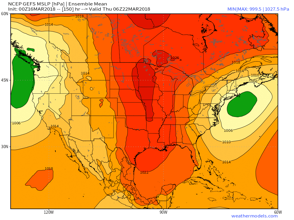
Now, on the contrary, the GFS ensemble mean looks more like the GFS operational which would result in the plowable event mentioned above.
With low confidence in any solution, and still 5 days to go to where the energy associated with this system has yet to be measured by our sounding data, we will just have to wait and see what the models do over the next few days. In any event, winter has to end at some point. If this event does verify, I do believe it will be the last one of the season as the NAO, PNA, and AO both show to favor a less active/cold pattern going into April.
-Michael Souza, MS 15′