
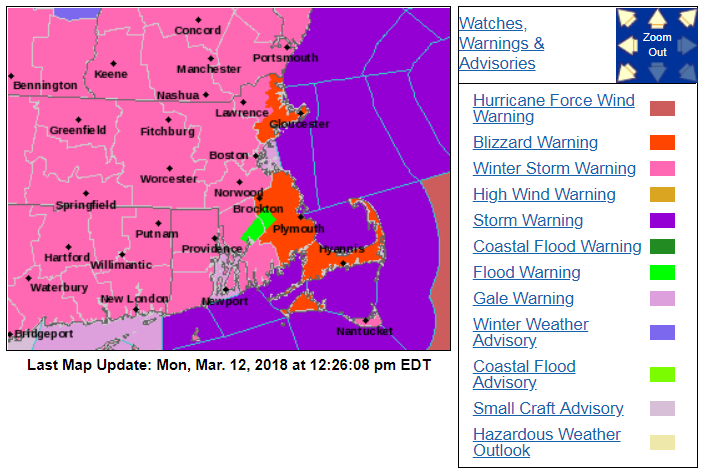
There is no rest for storm weary New England. Yet another Nor’easter will impact the region beginning around midnight and continuing throughout the day on Tuesday. Snow, wind, and coastal flood headlines are posted depending on where you live. Cold air will provide a “fluff factor” to the snow so the risk for power outages is much less with this storm across Central MA/RI/Merrimack Valley/Metrowest. The strongest winds and pasty snows will be confined to the Cape/Islands/Plymouth County. Strong winds will also be possible along the North Shore which is why blizzard warnings are posted here as well.
General Overview
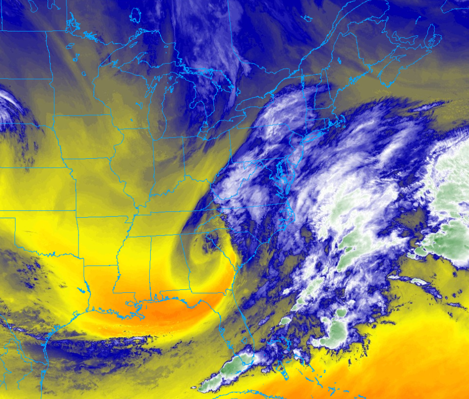
Surface cyclogenesis is underway off the Southeast coast as energy from the Southern jet taps into the gulf stream. Some northern stream energy will be infused into the system this evening and then its bombs away. Another “bomb cyclone” will track south and east of New England tonight and tomorrow. A meteorological “bomb” is when the mean sea level pressure drops 24 mb in 24 hours. By 8 AM tomorrow, the pressure will be down to 972 mb (give or take). Right now the pressure is around 1000 mb, easily qualifying this storm as a “bomb”.
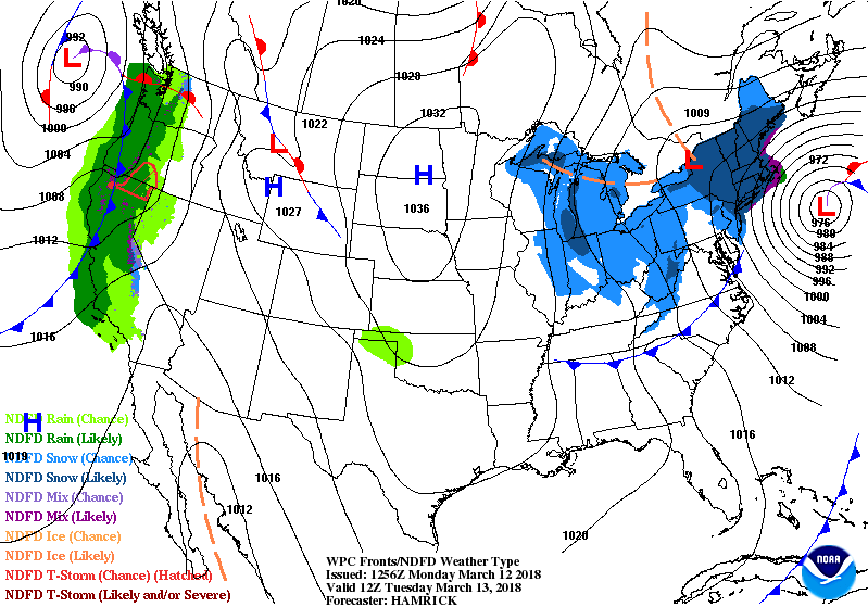
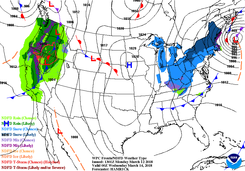
The exact track is still TBD, but it appears to be just outside the 40/70 benchmark that most of our most famous storms track near. The offshore track will help keep the cold air locked in place making this one all snow for everyone except the outer Cape and Nantucket. However, even though areas are expected to see at least 6″ of snow. The storm will track into the Gulf of Maine by tomorrow evening, shifting the heaviest snows to Northern New England.
Timing/Impacts/Totals
Snow arrives after midnight across Rhode Island and Massachusetts. The first heavy snow bands should arrive by 4 AM in Central/Eastern MA.
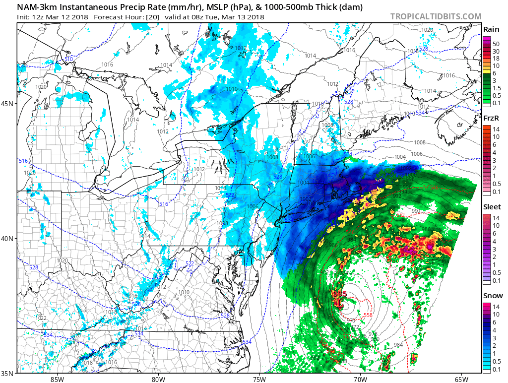
Intense snow rates of 1-3″/hr will batter the region throughout the morning. This will make the AM commute nearly impossible. Winds will peak in SE MA during the morning as well. Winds will gust 50-60 MPH across Plymouth County, the Cape, and Islands. This is why the blizzard warning is posted here. Temperatures will initially be in the low 30’s before falling into the upper 20’s by morning everywhere expect SE MA. The temp drop will happen as the wind direction shifts to a northerly component. Snow will fall moderate to heavy through the early afternoon, letting up by late afternoon in Central MA and early evening in Eastern MA. Snow will taper in Southern NH/ME by 8-9 PM before some backlash snows move back in after midnight.
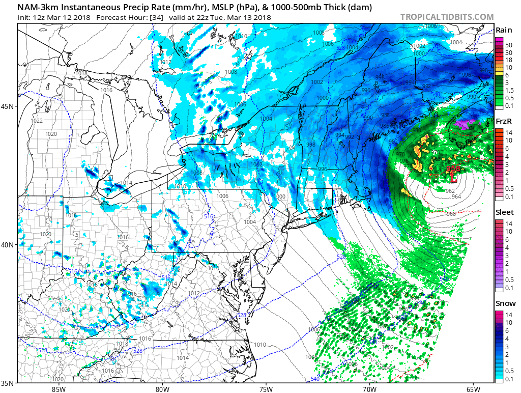
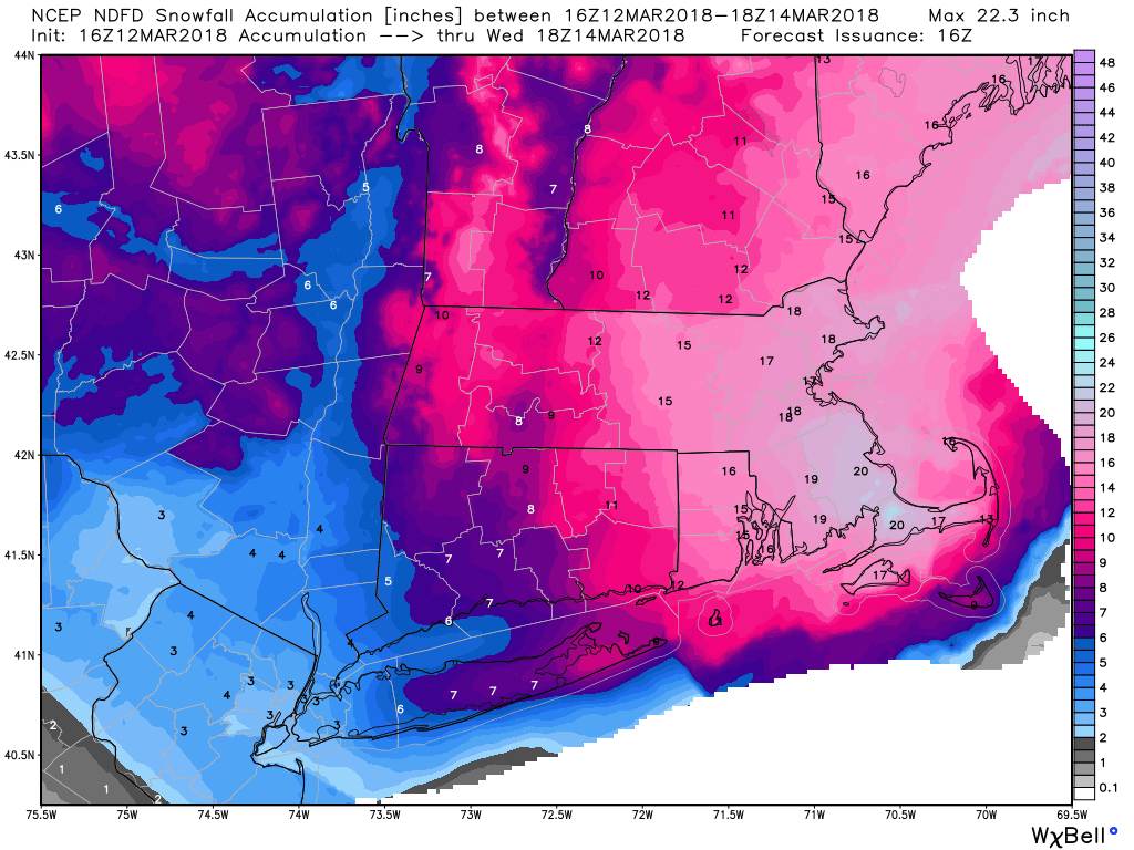
The National Weather Service is calling for over a foot of snow from Worcester County east. Although this may be a bit high, the fluffy snow and intense snow rates should overcome the high March sun angle and allow for a widespread 12″ snowstorm in Southern New England. The jackpot looks to be in SE MA near the canal. Impressive totals are forecast in the Blackstone and Merrimack Valley’s, as well as in and around Boston.
Light snows will remain on Wednesday although additional accumulation is not expected. Temperatures will be colder than normal through the rest of the week. Expect highs in the mid to upper 30’s on Wednesday and Thursday before a return to the 40’s for Friday and Saturday.
Stay safe.
-Zack Green (UML Class of 2011)