
Good evening everyone! It looks like we have our first notable snow event of the season on the horizon. Below is what you need to know!
Precipitation Type
This will be a very tough storm to predict the exact precipitation type. At this point, it looks like snow will most likely eventually change to a mix with sleet/rain or potentially pure rain, but the exact changeover time, the amount of mixing, and other variables are up in the air — and a mostly-snow solution is also possible, as is a solution with very little snow. As of now, though, it looks like the Lowell area will see at least some accumulating snow of note. This uncertainty is because a warm layer aloft will cross above southern New England, but only reach as far north as somewhere near the MA/NH border. Unfortunately for the Lowell area, this means a tougher forecast, as we will be right near the edge of significant mixing. There is at least an outside chance of some freezing rain, but the highest risk for freezing rain will be in central and western MA.
Timing and Impact
Snow will begin by mid- to late-morning Saturday. Precipitation will have the most impact on travel Saturday afternoon and evening, but won’t end completely until around sunrise Sunday. The good news is that given the long duration of the system, the precipitation won’t be overly heavy, though it will be enough to cause travel impacts (especially Saturday afternoon and evening when precipitation is likely to peak).
Barring any impacts from freezing rain, the travel impact won’t be major, but it will make things quite slow nonetheless. If you have to be out on the roads, make sure to take it slow and leave plenty of distance.
Amounts
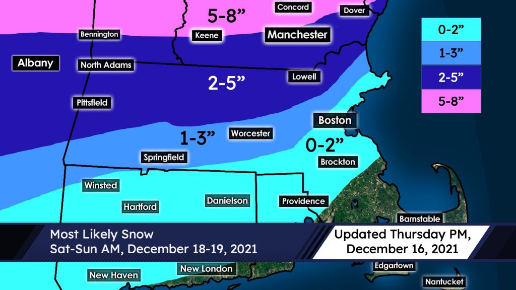
There is some uncertainty here given the extent of mixing is still up in the air. That said, a general 2-5″ looks likely in the vicinity of the MA/NH border, including Lowell. It’s a fair question as to whether we will be on the lower or higher end of the range; it’s too early to sort that out. To the south, expect a quick drop-off to little/no snow as mostly rain is likely south of the Mass Pike as well as along much of the coastal plain. Especially locally, amounts could decrease dramatically with only a slight change in the track of the system.
To our north, a widespread 5-8″ snow is likely for much of New Hampshire, Vermont, and western Maine. The snow in most locations will be heavy and wet; however, if you are headed up to far northern New England (north of Concord, NH), the snow will be a bit fluffier up that way. (The amounts will be similar though, because the fluff factor to the north compensates for lower liquid equivalents).
Another update will be posted by tomorrow evening. The situation will continue to evolve, so stay tuned!
Nathan Coram
UML AMS Co-President