
Good morning! Here’s a full update on the upcoming snowstorm.
Amounts
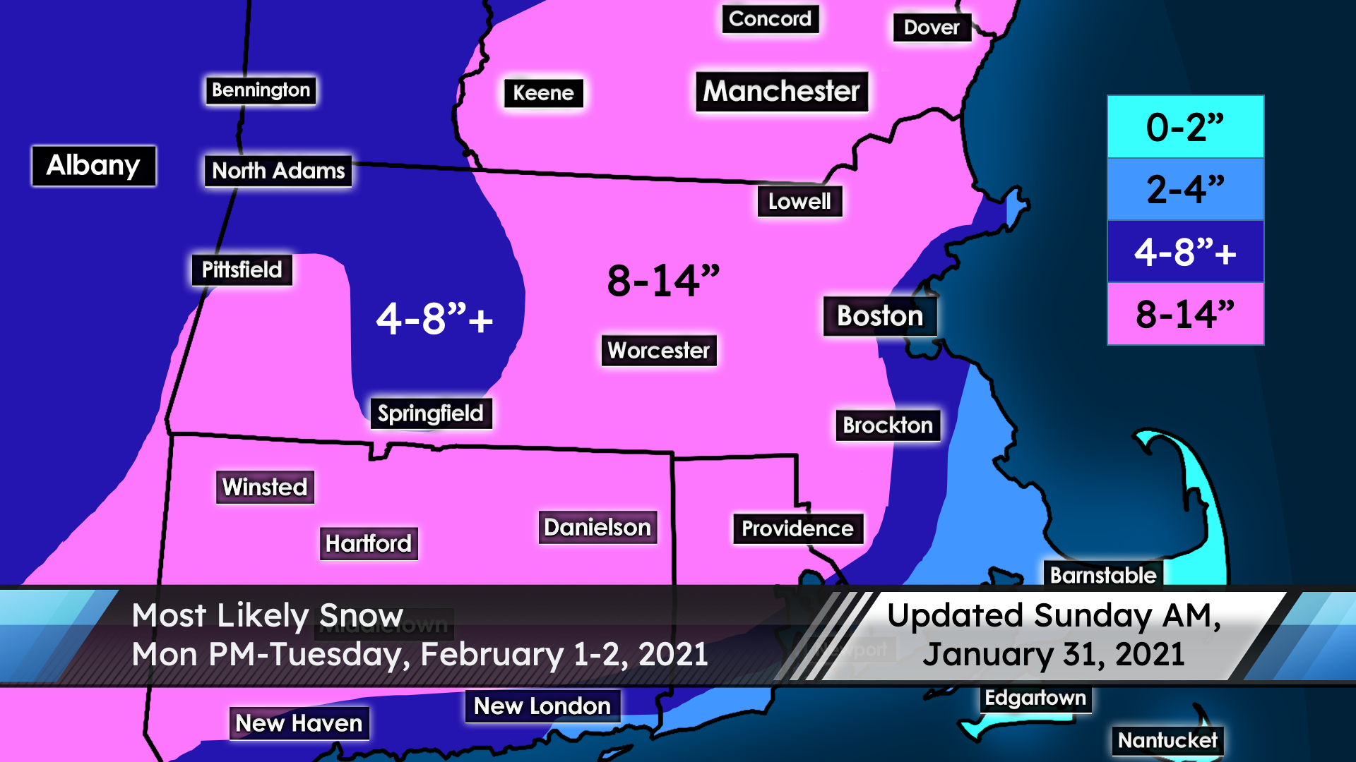
Expect a widespread 8-14″ in much of interior southern New England, including the Merrimack Valley. 4-8″ totals are likely a bit closer to the coast (especially inside of I-95 near Boston), as well as in parts of western New England further from the key moisture of this storm. Mixing will be an issue near the coast; 2-4″ can be expected at Cape Ann, as well as in much of southeastern Massachusetts (with 0-2″ for Cape Cod and the Islands). There is some uncertainty on snow totals near the coast.
Timing
The system has sped up a bit since the last update. Snow begins midday Monday, and may impact the evening commute. However, the bulk of the accumulating snow will be Monday evening into Tuesday morning. The heavy snow ends by mid-morning Tuesday, but flurries and light snow may continue into Tuesday afternoon.
Impact
The snow will be roughly average weight, at least locally. It won’t be fluffy, but I also don’t expect anything unusually heavy and wet. (Note that snow will likely be at least a little wetter near the coast and especially south of Boston.) There is a threat of downed trees and power outages, though, due to strong northeast winds of 10-20 mph, with peak gusts up to 40 mph. Blizzard conditions are possible at times with poor visibility. Driving will be extremely hazardous Monday evening into Tuesday morning, so stay off the roads if possible.
Uncertainty
This is a high-confidence forecast inland; the only major concern locally would be if the dry slot aloft moves in earlier than expected, which would undercut snow totals a little bit. Most of the uncertainty involves amounts closer to the coast, as it’s not impossible that coastal locations (even south of Boston) could see up to a foot of snow with the initial band Monday evening and night before changing to rain.
I’ll have more info tonight if necessary. Have a great day!
-Student Forecaster Nathan Coram