
by David Coe, EEAS Ph.D Student
New England is bracing for impact from Tropical Storm Fay this weekend that could bring torrential rains, heavy winds, and strong embedded storms to the region.
Although uncommon, New England does see its fair share of Tropical Cyclones, but mainly as post-tropical storms.
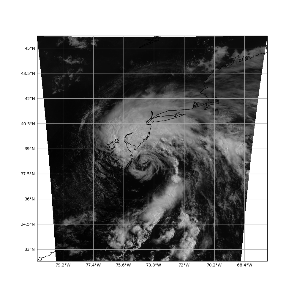
Tropical Storm Fay being the 4th such storm in the 21st century to make landfall in New England. Traditionally when talking about landfall, we consider the first place a hurricane hits land, but in this case, we are looking at storms which entered land in New England even if they had already hit land previously. The last Tropical Storm to make landfall in New England was Tropical Storm Beryl in 2006, and was the last Tropical Storm to make landfall in New England during the month of July! Let’s take a look at what we are likely to see this weekend.


Above we see the National Hurricane Center’s Cone of Uncertainty forecast for Tropical Storm Fay as well as the current NWS watches and warnings for the Northeast U.S. It looks like Tropical Storm Fay will make landfall as a Tropical Storm along the New Jersey coast and travel along the MA/NY border. This is a slight shift westward in the track, so NWS has opted to cancel the Flash Flood warning for Central and Eastern MA as the heaviest of the rain looks to fall in Western MA and NY state.
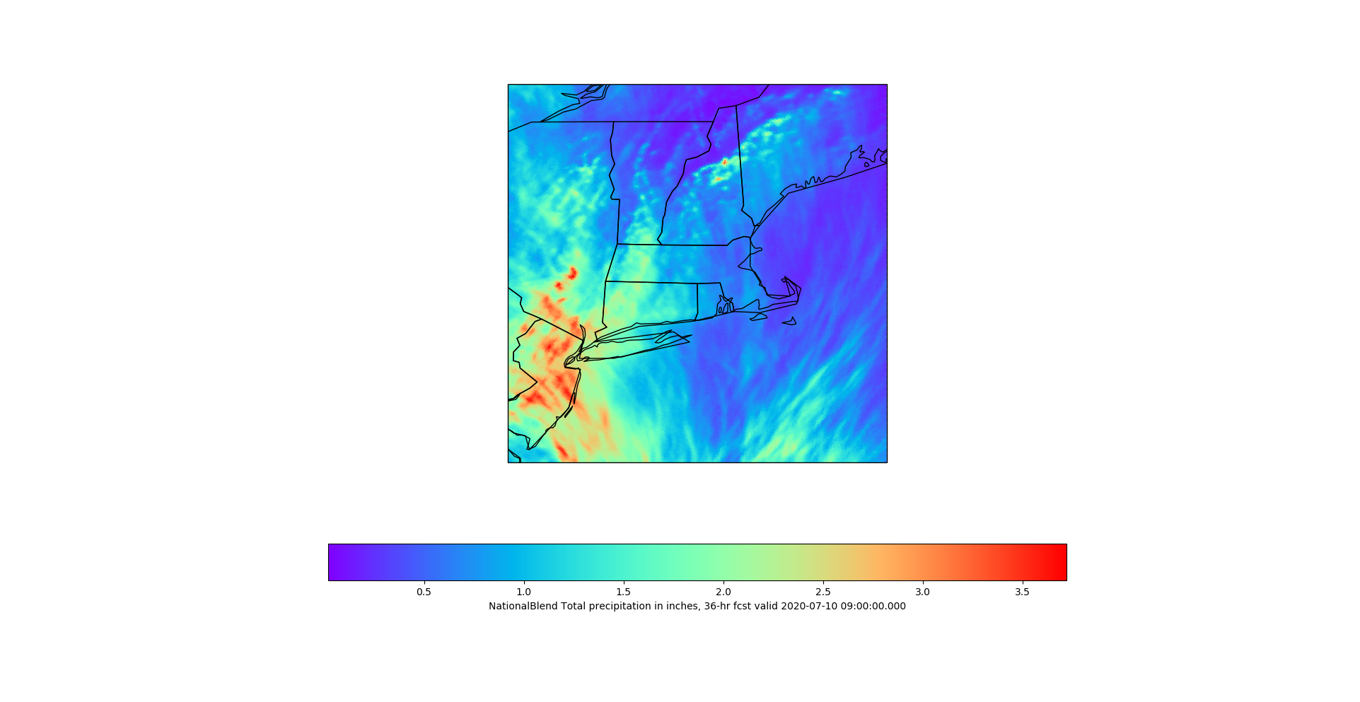
Above is a blend model of total precipitation from the tropical storm for the Northeast Region. Areas where the storm crosses over and to its west look to receive upwards of 3-5″ by the end of the storm, with lesser amounts to the East. Western MA should receive 2-4″ of rain, while Central and Eastern MA may luck out and only see 1-2″ of rain out of the whole ordeal. Central and Eastern MA will need to keep an eye on the formation of some convective storms, as there is a low level jet and helicity (spin) to the east of Tropical Storm Fay. The best chances for any tornados would be closer to the center of Tropical Storm Fay, however the likelihood of a tornado is low, but not none, so it will need to be monitored closely.
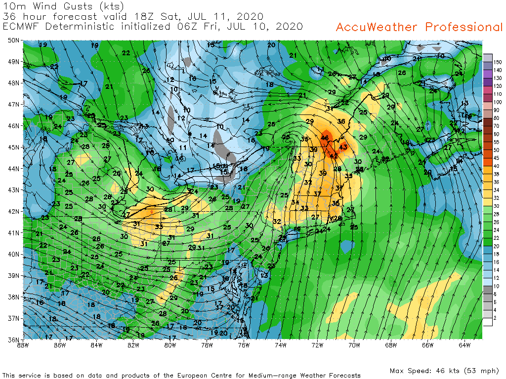
Wind gusts may be the biggest story for most of New England as most of the region looks to see wind gusts peak around 45 mph by Saturday Afternoon. This could cause localized power outages due to downed power lines and downed tree limbs.
Overall, the impact from Tropical Storm Fay to New England looks minimal, but it will still bring us some much needed rain to the region.