
by Mathew Barlow, EEAS Professor of Climate Science
This post includes twenty short animations from our undergraduate two-course sequence in atmospheric dynamics. Topics covered include vorticity, waves, and instability.
The code used for these animations can be found through https://storm.uml.edu/~metweb/Blog/?p=578 and https://github.com/mathewbarlow/simple-atmospheric-models.
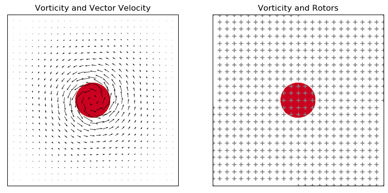
1. Winds and rotors for an idealized vortex
Embedding rotors (‘+’) in the flow allows a visualization of where the flow has local rotation (vorticity) — where the rotors are turning about their axes rather than just moving. For more discussion, see: https://storm.uml.edu/~metweb/Blog/?p=487.
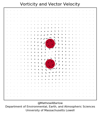
2. Co-rotating vortices
Two vortices rotating in the same direction can orbit around each other – the Fujiwhara effect. For more discussion, see: https://storm.uml.edu/~metweb/Blog/?p=487.
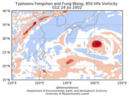
3. Observational example of the Fujiwhara effect
The interaction of Typhoons Fengshen and Fung-Wong provide an example of the Fujiwhara effect for different-sized vortices. For more discussion, see: https://storm.uml.edu/~metweb/Blog/?p=487.
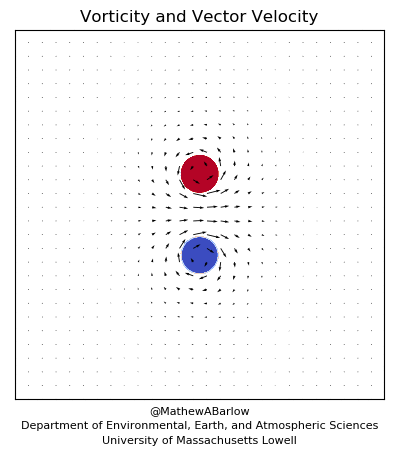
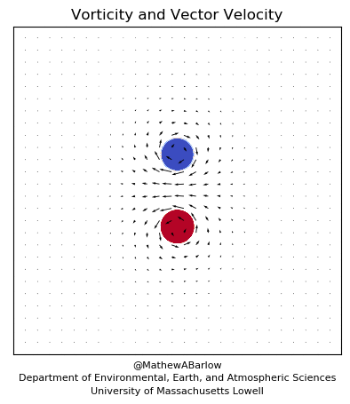
4. Counter-rotating vortices, eastward movement
Two vortices rotating in opposite directions can move together. For more discussion, see: https://storm.uml.edu/~metweb/Blog/?p=487.
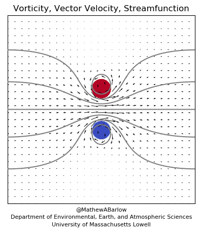
5. Counter-rotating vortices, westward movement
Two vortices rotating in opposite directions can move together (reversed positions, in this case). For more discussion, see: https://storm.uml.edu/~metweb/Blog/?p=487.
6. Conceptual model of a jet streak
A jet streak can be thought of as two counter-rotating vortices in a westerly flow. For more discussion, see: https://storm.uml.edu/~metweb/Blog/?p=487.
7. Conceptual model of a Rex block
A Rex block can also be thought of as two counter-rotating vortices (reversed positions) in a westerly flow. There isn’t much movement in this animation because it’s a block. For more discussion, see: https://storm.uml.edu/~metweb/Blog/?p=487.

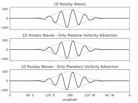
8. 1D Rossby waves
Zonal propagation of Rossby waves, with the group outlined in gray. Note that the group travels faster than the individual troughs and ridges. Code available at: https://github.com/mathewbarlow/simple-atmospheric-models.

9. 1D Rossby waves, separating advection terms
Zonal propagation of a group of Rossby waves, with separate panels for just the relative vorticity advection term and just the planetary vorticity advection term.
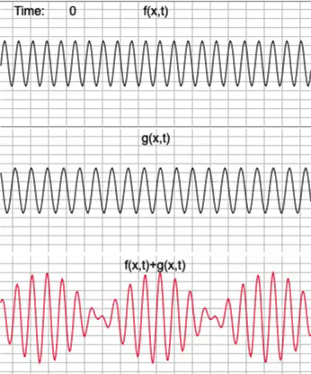
10. Phase and group velocity in the sum of two waves
Only two waves are needed for things to get interesting. In this case, notice that the two waves are moving eastward while the groups present in their sum (red) move westward. The animation was made using the interactive website http://pages.iu.edu/~kforinas/physlets/waves/waveX2A.html.
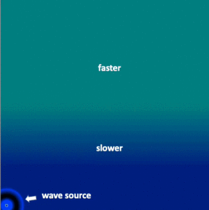
11. Simple refraction example
From the interactive simulation at: https://www.falstad.com/ripple/, with annotation.
12. Waveguide example
From the interactive simulation at: https://www.falstad.com/ripple/.

13. Inertial oscillations
Motion of a parcel with an initial velocity and acting only under the influence of the Coriolis force (no pressure gradient). Code available at: https://github.com/mathewbarlow/simple-atmospheric-models.
14. Idealized response to El Nino
Barotropic Rossby wave response to idealized tropical forcing, where the basic state is in solid body rotation. Code available at: https://github.com/mathewbarlow/simple-atmospheric-models.

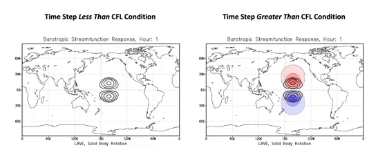
15. CFL condition
In a numerical solution, the time step must be smaller than the CFL condition (set by the fastest wave in the system), otherwise error grows rapidly. Both panels show the same calculation, but with the time step meeting the CFL condition on the left and not meeting it on the right.
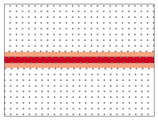
16. Barotropic instability
Under certain conditions, flow with horizontal shear is unstable: small disturbances grow rapidly. In the animation below, the dots follow the flow and the red indicates vorticity. The simulation starts with a tiny amount of noise added to parallel flow.
17. Barotropic instability with vortex interactions
This is a similar case but with different graphics and run for a longer time. The flow breaks up into vortices which then interact with each other through merger, straining, and orbiting.
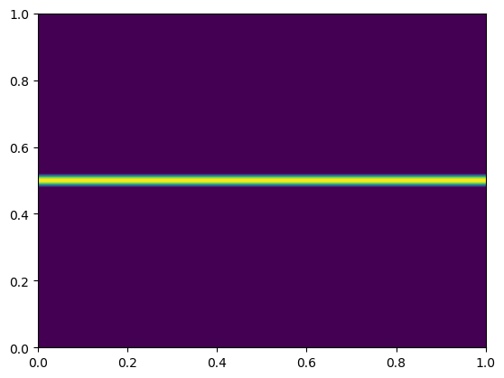
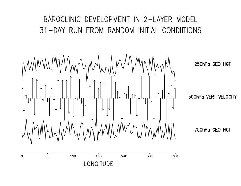
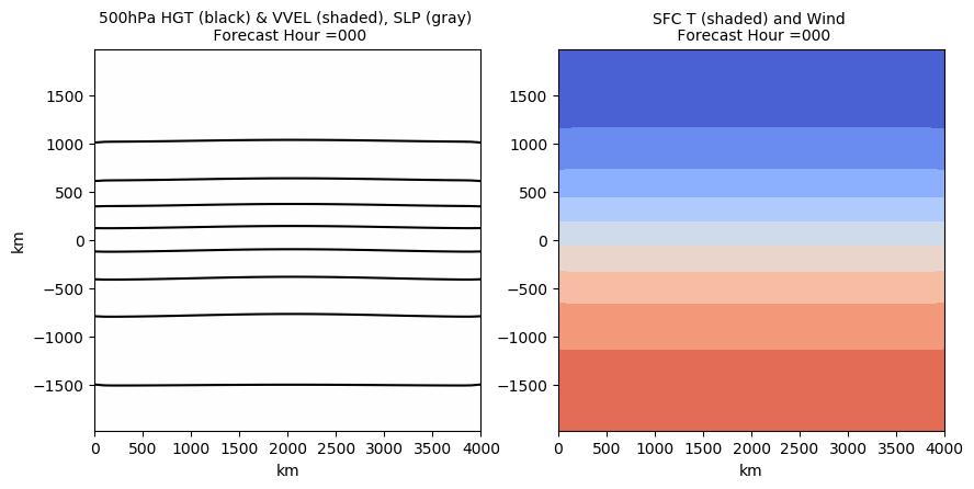
18. Baroclinic instability in a two-layer model
Large-scale flow with a horizontal temperature gradient can also be unstable: this is the process by which synoptic storms develop. Via the thermal wind relationship, we can also think of this as instability due to vertical wind shear. This animation shows baroclinic instability in a simple two-layer model. Code available at: https://github.com/mathewbarlow/simple-atmospheric-models.
19. Baroclinic instability in a forecast model
This animation shows baroclinic instability in a full 3D model (the WRF).
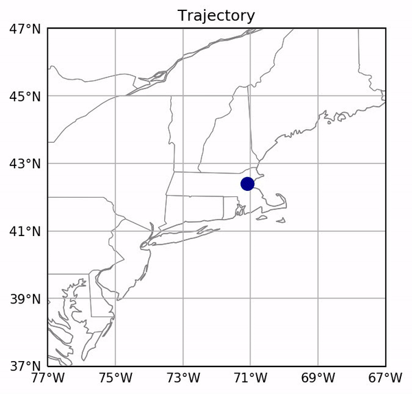
20. Development of atmospheric circulation from rest
Finally, this animation shows the development of the global atmospheric circulation when a model is started from rest (no winds, no horizontal variations in any of the atmospheric variables). Vectors show 200 hPa wind and the shading shows precipitation.
