
Say it ain’t snow!?!?!?!? We are seeing another shot of snow this weekend, in what continues to be a weird springtime. For the past couple of months we have been tumbling back and forth between warm, spring-like weather and cold, winter-like weather. This is the norm for New England in terms of spring weather, we tend to see two springs. The first spring usually occurs in February/Eary March and brings us an early shot of warm weather, before winter retakes its grip on the region. Then our second, “traditional” spring comes towards April. This is a phenomenon that has been observed especially over the last 30 years of data, but we will save that discussion for another post!

We have been stuck in this lull between the two springs this year in April/Early May rather than March, due to the lack of winter patterns we saw. We never really saw our warmup towards the end of winter which we usually see, which are our transition into spring slower. This has lead us to see these cooler weather storms with snow this late into May! Let’s look further into this weekend’s weather!
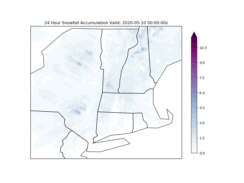
Above is the expected snowfall for tomorrow morning based on our in house weather model. This, as with most spring snow storms, will be light on the accumulating snow. We can expect close to a dusting in our area, with more snow further north and west. The real story is the cold air and winds that will be accompanying this system,
You may ask, it’s been in the 60’s all week and now tomorrow it is going to snow??? You can thank your good old friend the Polar Vortex for that! It never really broke apart this winter and stayed relatively strong up over Canada, which is why we saw such a mild/snow less winter.
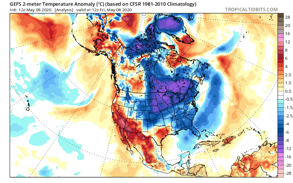
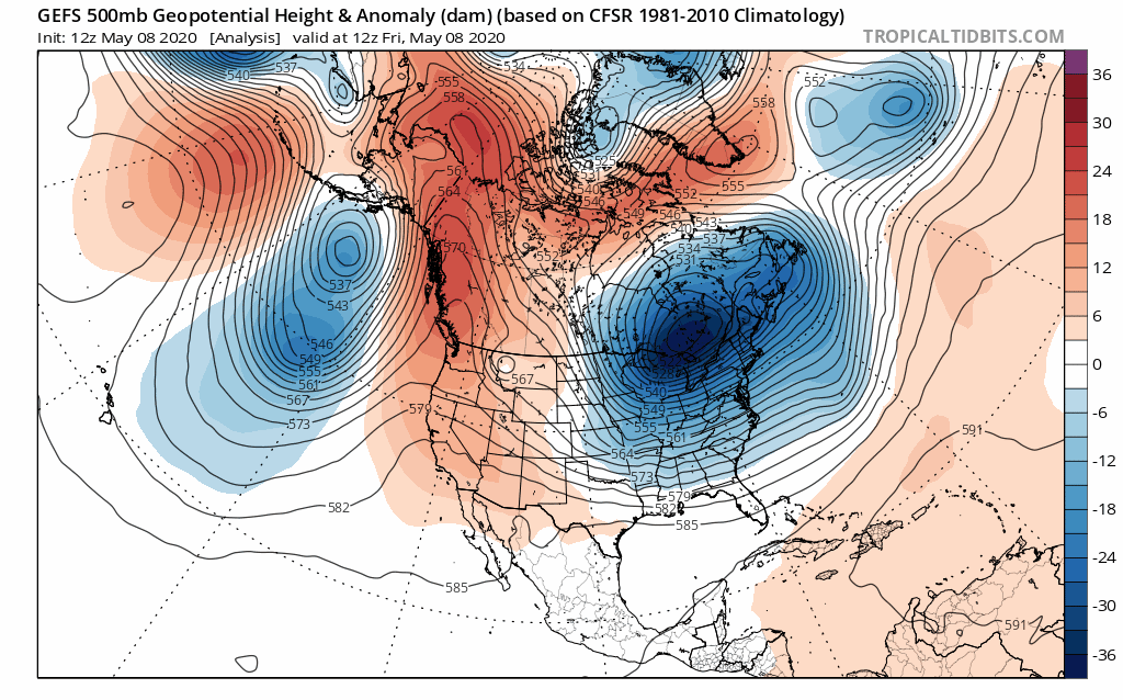
The top image shows the mid-level atmospheric height anomalies and the bottom shows the surface temperature anomalies for the next 48 hours. Blue signifies lower than average while red res presents higher than average. We can see that there is a strong, cold air mass that is moving out of Canada to our Northwest and passes over us over the next two days. Accompanying it, temperatures will fall almost 14-20 degrees below average, average high for this time of the year is around 67 and average low is around 46 degrees. This means temperatures during the day look to be stuck in the 40s with lows during the night stuck in the upper 20s to low 30s!
Why is the polar vortex all of a sudden coming down at us? Well, seeing a later transition to spring didn’t help weaken the polar vortex, but also the natural changes in circulation patterns that occurs in the spring has lasting effects as well. Normally in spring, we see a switch to winds mainly out of the West due to a higher sun angle and naturally warmer air. Unfortunately, this combination is causing a dislodging of the cold air mass to our Northwest, bringing it into our region. Luckily, the natural circulation patterns in spring also mean that this cold air won’t stick around too long, so the cold air will be out by the beginning of next week!