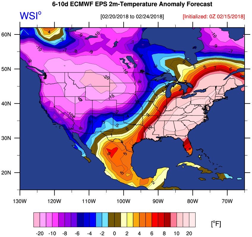
Last week saw us having record warm temperatures for both Tuesday and Wednesday with Highs reaching over the 70° mark both days smashing records that dated back to as early as 1954. Here is a list of the records we broke:
Tuesday Feb. 20th:
New Record: 70°
Previous Record: 62° – 1954 and 1994
Wednesday Feb. 21st:
New Record: 76°
Previous Record: 61° in 1997
February:
New Record: All time high temp for month 76°
Previous Record: 73° set on Feb. 24th, 2017
Winter (Dec – Feb):
Tied Record: Season high temp of 76° From 12/7/1997
While we were having these warmer than average temps, the western U.S. was engulfed in a massive area of cold air and set many records of their own for coldest temperatures in February and many areas saw large amounts of snowfall over this period. The question is what was the cause? The leading theory is that it has to deal with the polar vortex split that occurred over the Western U.S.
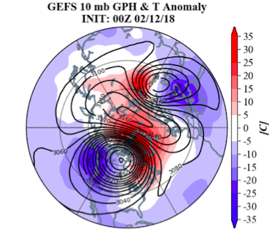
The graphic above shows the split of the polar vortex in the upper levels as modeled by the GFS. Areas in red show warmer than average temperatures and blue show colder than average temperatures. This split caused cold air to flow down into the western U.S. as the cut-off upper level area of cold air caused a trough to deepen through the western U.S. Because of the amplitude of this trough along with the large cut-off in the upper atmosphere, a large ridge formed to the east of the trough (over the Eastern U.S.) and progressed forward at a slow rate (approx 1-2° lat per day).
This large amplitude ridge brought warmer than average temperatures further north than usual during the winter season, causing our area to see record setting high temperatures in the mid 70s.
The polar vortex split is closely related to a Sudden Stratospheric Warming (SSW) event that also occurred around the same time last week over the Arrctic. This caused warm air to rush in at the lower levels of the stratosphere, which usually leads to a split in the Polar Vortex like we saw this past week. To say this is the definitive cause is still tough as this event has yet to be analyzed fully, but it is the leading suspect.
Since, the polar vortex split has weakend and the trough has filled, bringing an end to the extreme cold in the west and the record warmth in the East. This isn’t to say we won’t see any more record warm days this winter season, but all eyes right now are on March and the changing pattern that could favor a return to more winter-like weather.
– Dave Coe
P.S. Thanks to Scott Kaplan and Dr. Frank Colby for the data and Dr. Matt Barlow for the information on the SSW


